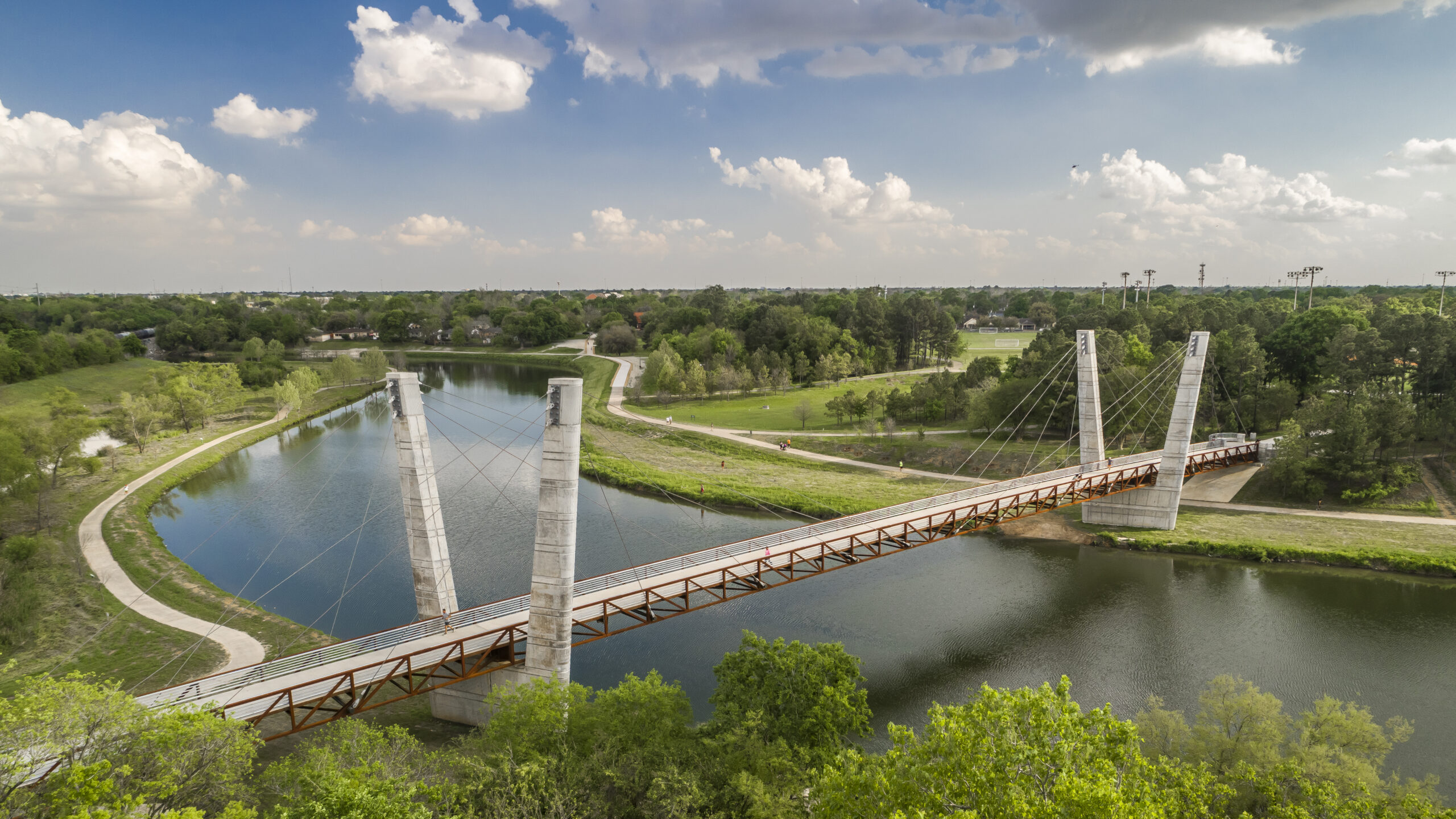


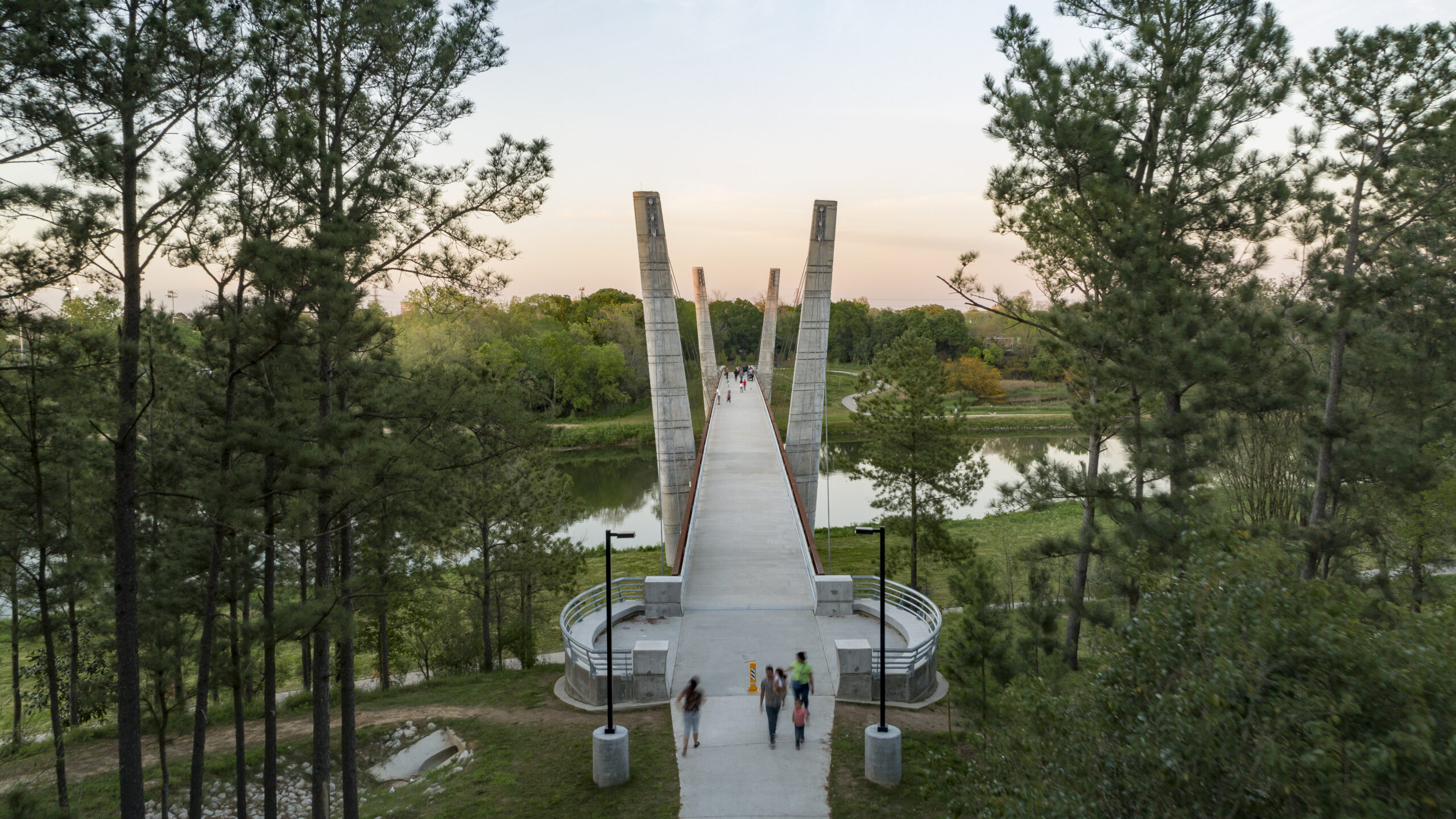

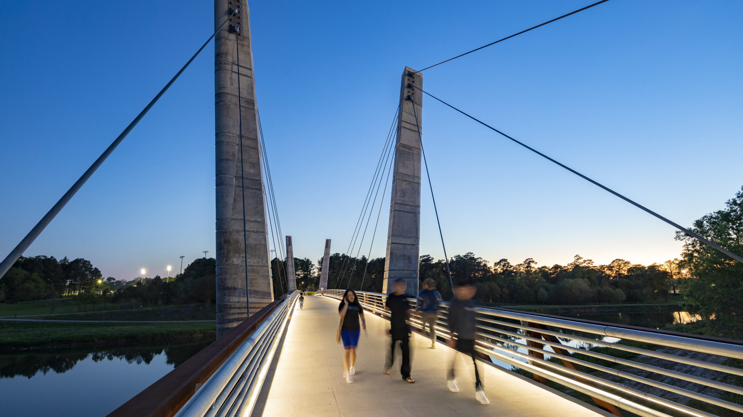


Mason Park, located at the confluence of two bayous, has served as an urban oasis since 1928. Despite a century of improvements to amenities, user access was significantly compromised by the wide expanse of Brays Bayou, which bisected the 104-acre green space into distinct northern and southern sections. Adjacent road and rail infrastructure further exacerbated accessibility issues for surrounding neighborhoods.
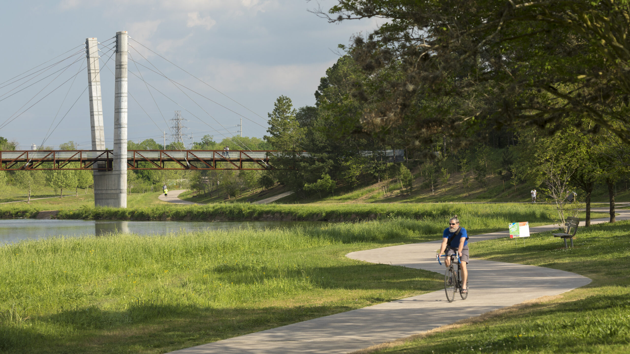
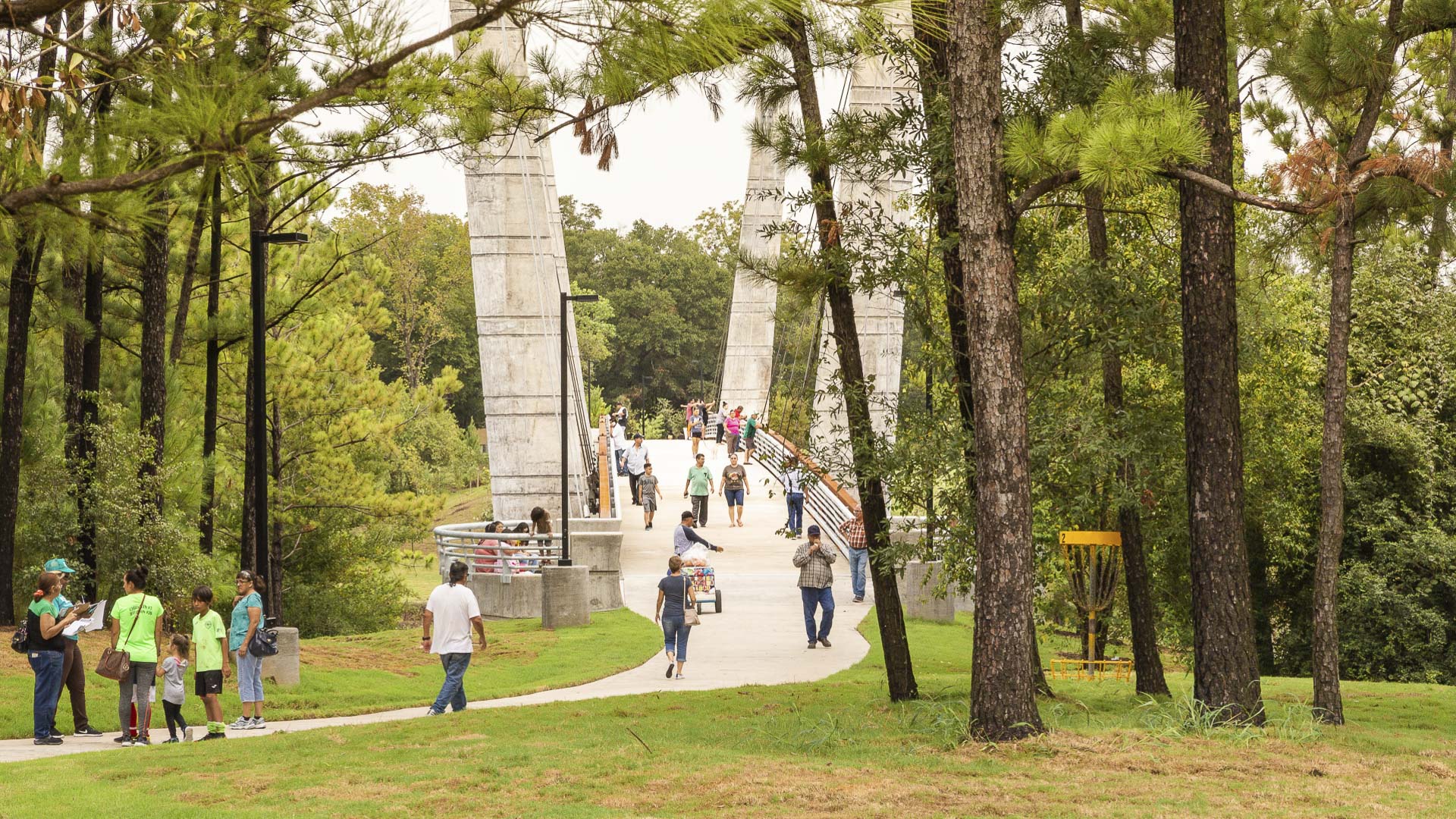
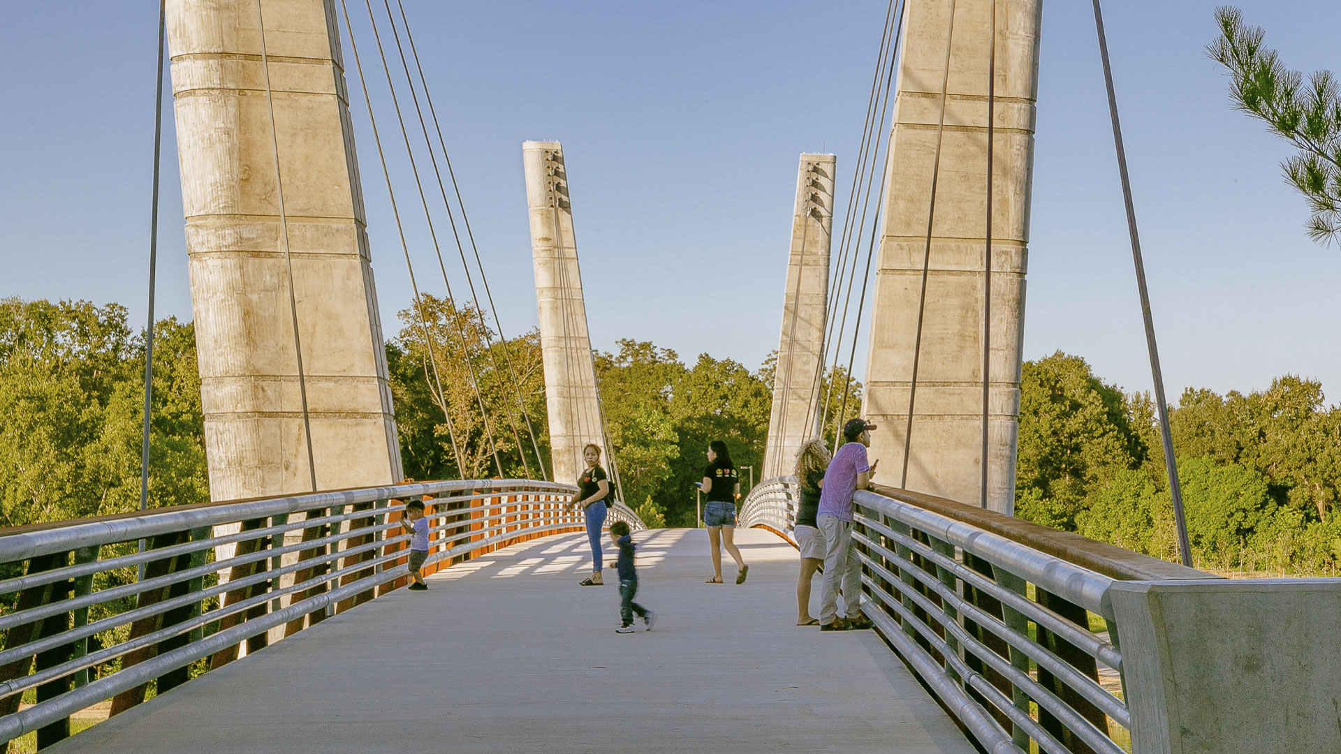
The Mason Park Bridge, a 485-foot cable-stayed, truss-decked structure spanning the bayou, now connects the two park areas and provides an iconic destination for cyclists and pedestrians utilizing the lower Brays Bayou trail system. The bridge also unites the Magnolia Park, Lawndale, Wayside, Pecan Park, Harrisburg, and Manchester communities, serving as a focal point for the neighborhood.
The design strikes a delicate balance between park aesthetics and bayou health. The team considered factors such as bridge height, span, bayou width, and pylon placement to minimize the impact on the area’s hydrology, creating a harmonious blend of engineering and nature. The result is a landmark crossing that grants park-goers access to community amenities while establishing a vital connection between two revitalized park areas.
Mason Park Bridge is a component of a broader initiative aimed at rejuvenating the ecology of Houston’s 4,000-acre Bayou Greenway arterial park system through the addition of trails, seating plazas, and lighting. As Houston grows, Mason Park Bridge serves as a catalyst for equity, promoting access to green spaces and fostering a sense of connection between the neighborhood’s surrounding Mason Park.

Shunde New City
The Pearl River Delta is the second largest bird migration delta and estuary in Southeast Asia. Preserving and restoring bird and wildlife corridors while also providing regional connectivity, transportation, and development options is at the pinnacle of today’s development challenges. In the Shunde New City Plan, urban development and nature are integra...
Thousand Oaks Urban Forestry Master Plan
While residents and businesses are clearly proud of the City of Thousand Oaks’ two-decade-long “Tree City USA” designation, recent drought conditions created an urgent need for the City to decrease grassy landscapes and update maintenance practices. As a key part of these efforts, the City selected SWA, along with team partners Planning & Energy/Entitlemen...
Milton Street Park
Milton Street Park is a 1.2-acre linear urban park alongside the Ballona Creek Bike Trail in Los Angeles, California. The plan incorporates numerous green-design elements, including the use of recycled materials, native planting, flow-through planters and treatment alongside the 1,000-foot-long, 45-foot-wide stretch of land. A variety of special elements such...
Rosemont Pedestrian Bridge and Trails
The Rosemont Bridge and connecting trails layer pedestrian infrastructure onto the Buffalo Bayou corridor in Houston, Texas and is a significant step in realizing the larger vision of a more accessible Houston. Running through downtown Houston, Buffalo Bayou is one of the significant natural bayou corridors in the City, but is cut off from adjacent neighborhoo...