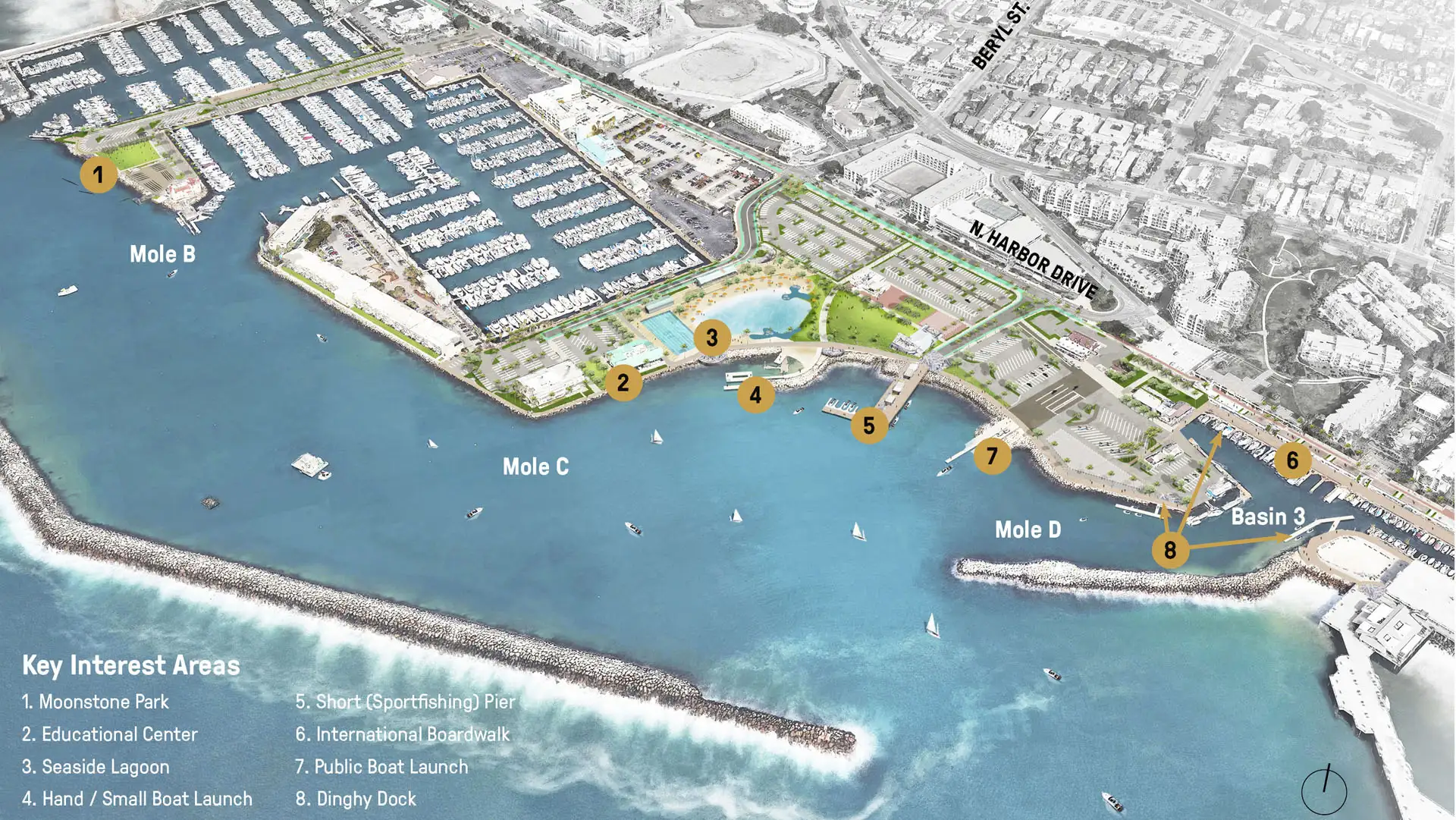
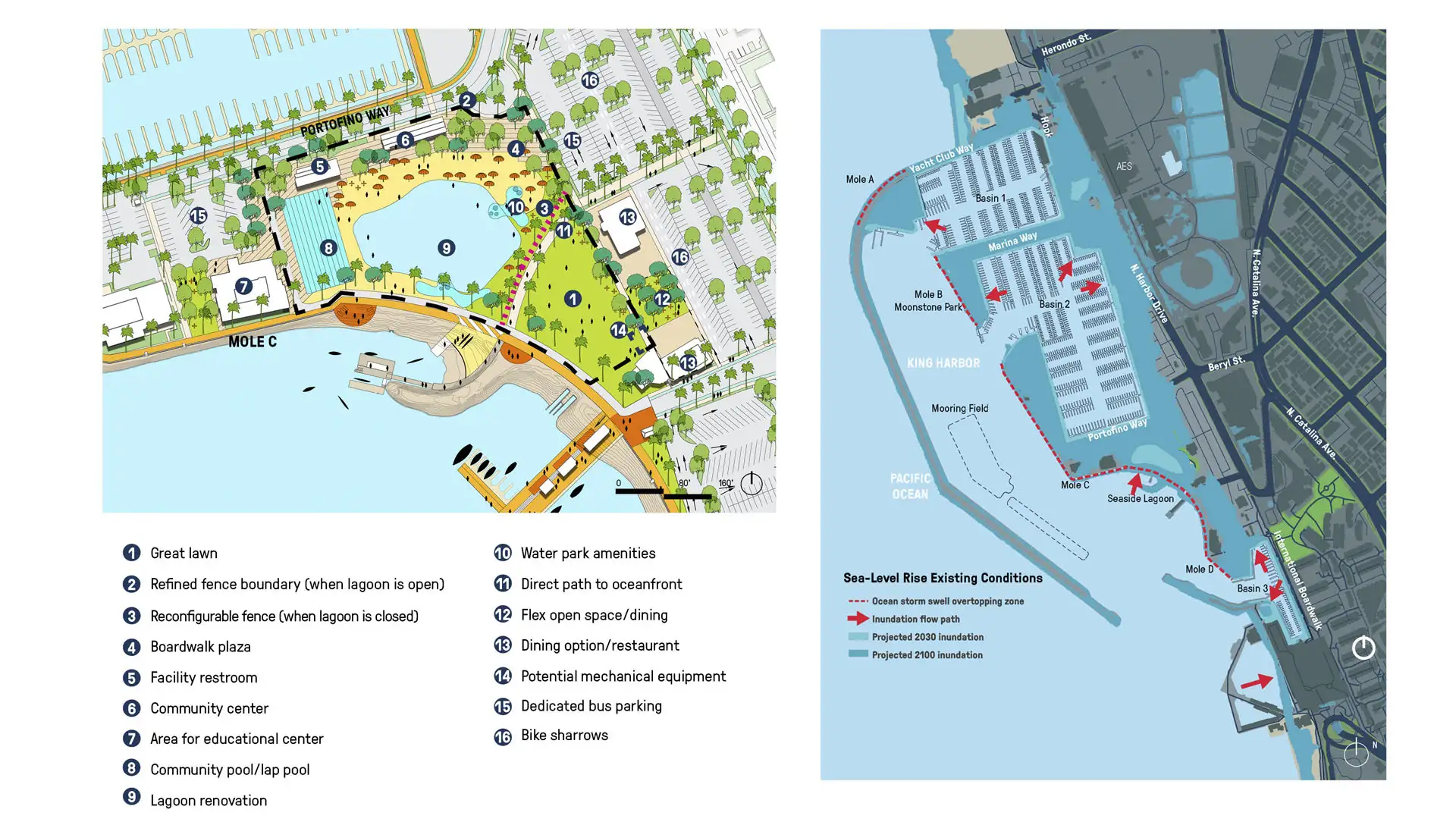
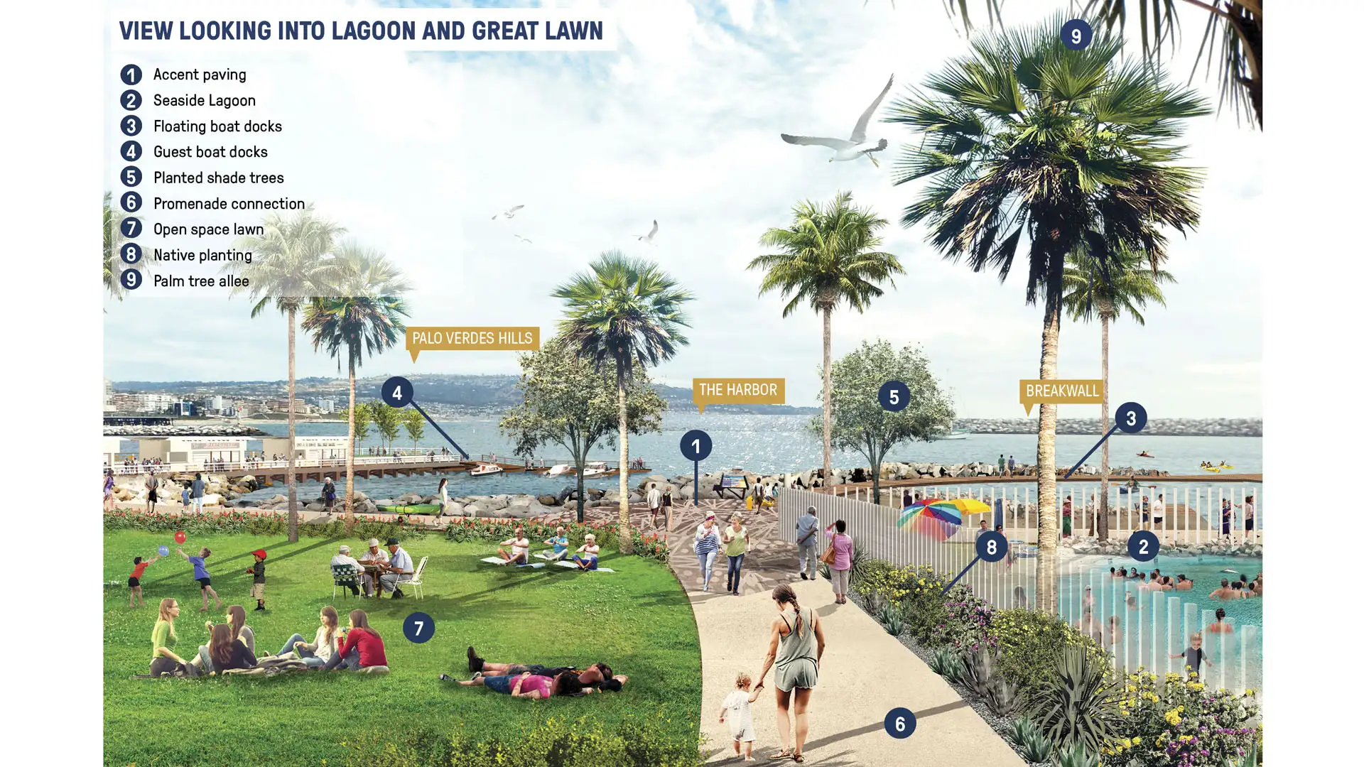
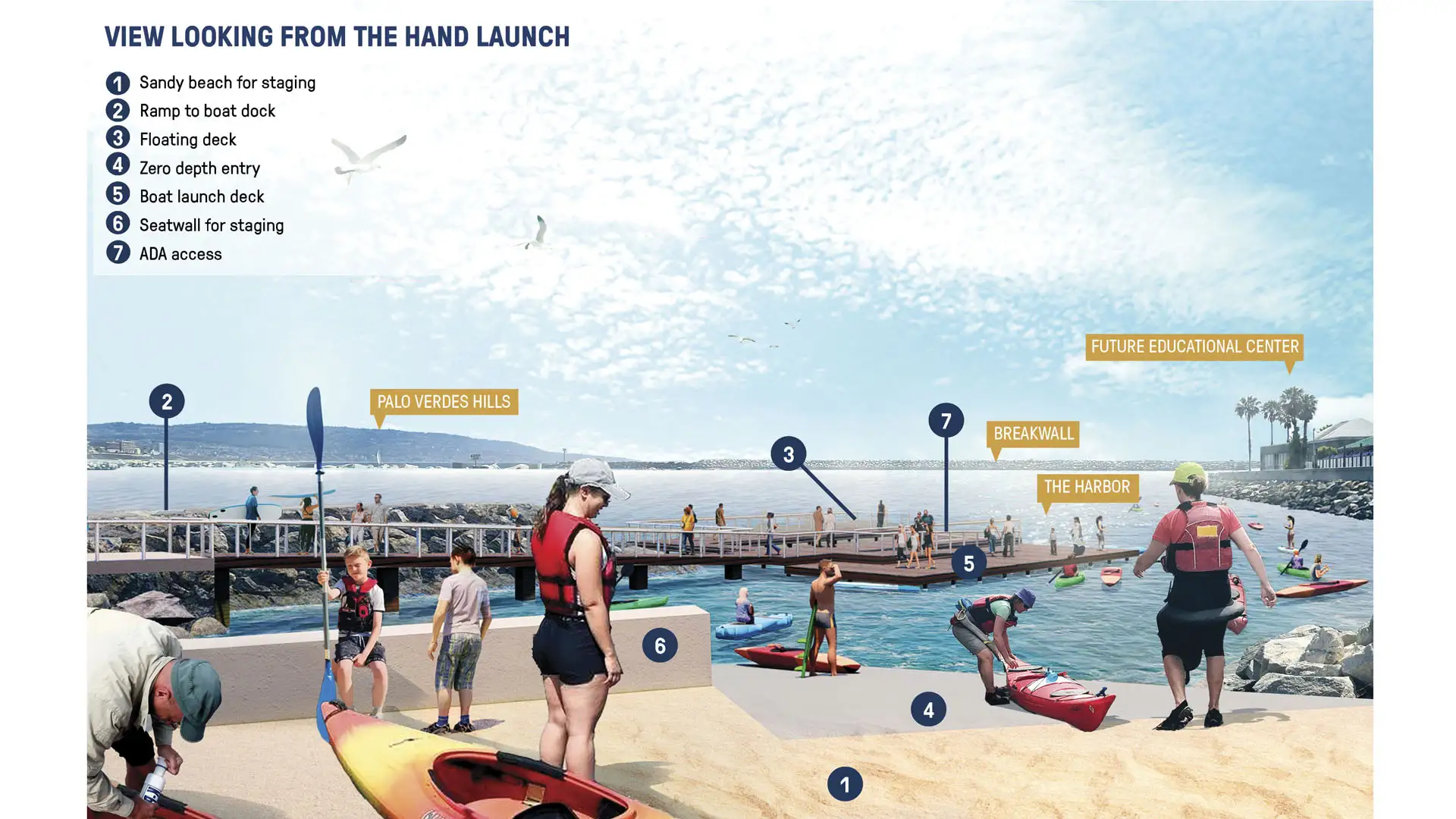
SWA’s work on the King Harbor Public Amenities Plan manages the site’s vulnerability to severe ocean conditions by updating existing infrastructure, providing new programming, and creating a plan for sea-level rise and King Tides. The Amenities Plan serves as a powerful tool to guide growth both for the waterfront’s immediate future and its long-term success. SWA conducted a feasibility study to determine which areas to rebuild or renovate; how to improve public access and connectivity; and implementation and phasing for the waterfront’s overall longevity.
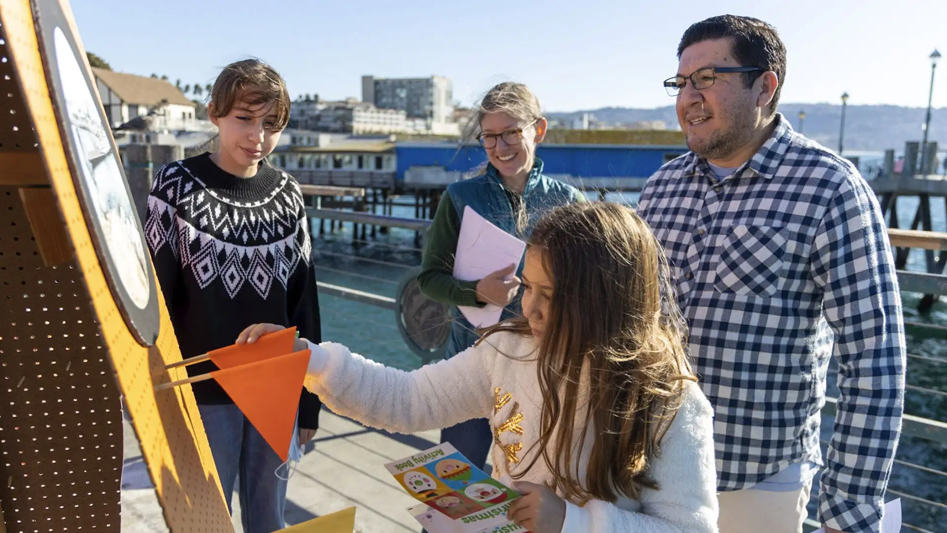
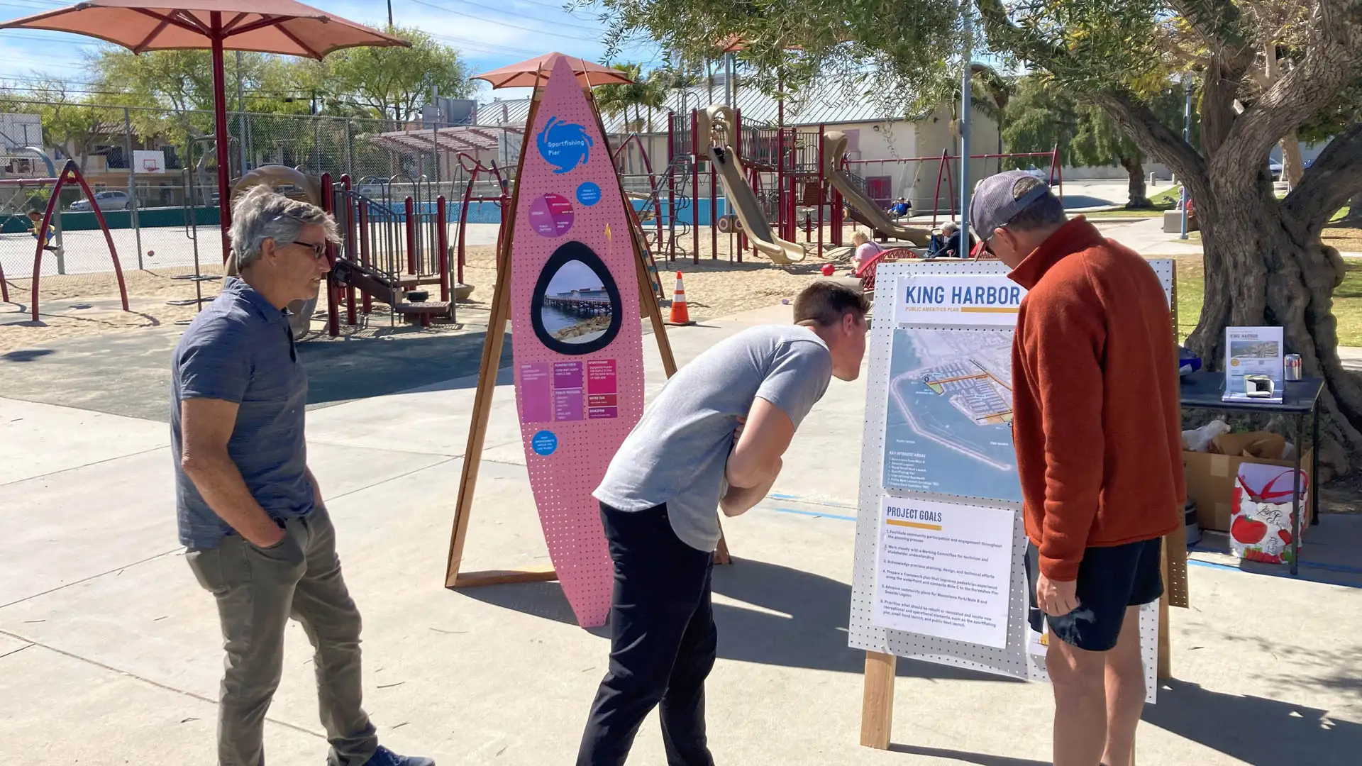
To bring all project components to life, the team identified funding sources, built partnerships with stakeholders, including a dedicated city-organized “working committee”, and advanced designs. The design team leveraged a creative and multi-layered community outreach approach that included in-person, on-site interactions in concert with online participation, through virtual meetings, social media outreach, and online surveying, to allow residents to express their views organically and in their own time.
John Wayne Airport
SWA served as landscape architects at the new airport terminal located in urban Orange County. Landscape improvements, totaling 20 acres, consisted of a large open area adjacent to the terminal, and narrow planting areas framing the site. The particular challenge was to create an appropriate image and scale for a civic project of enormous scale, including park...
ARTIC – Anaheim Regional Transportation Intermodal Center
ARTIC, the new 16-acre Anaheim Regional Transportation Intermodal Center in Southern California, forms a seamless gateway from Anaheim to all of Orange County, spurring economic growth and community redevelopment throughout the region. The landscape design establishes a unique and identifiable image for the ARTIC Mixed-Use District by complementing the site’s ...
Guangzhou Axis District Planning
The Guangzhou Green Axis District Urban Design paved the way for new growth in one of China’s major metropolitan areas by bringing nature into the city, connecting people to the river and CBD, and providing a major park and open space for all ages. In the early 2000s, when the project commenced, Guangzhou was a rapidly growing city of approximately 8 million. ...
Lewis Avenue
In a city renowned for fantasy, the design of Las Vegas’ Lewis Avenue celebrates the local desert landscape and affirms the street as part of a real-world working district. It was one of the first projects to be implemented in Mayor Oscar B. Goodman’s 2000 Las Vegas Downtown Centennial Plan, aimed at revitalizing the historic downtown core. The City asked SWA,...


