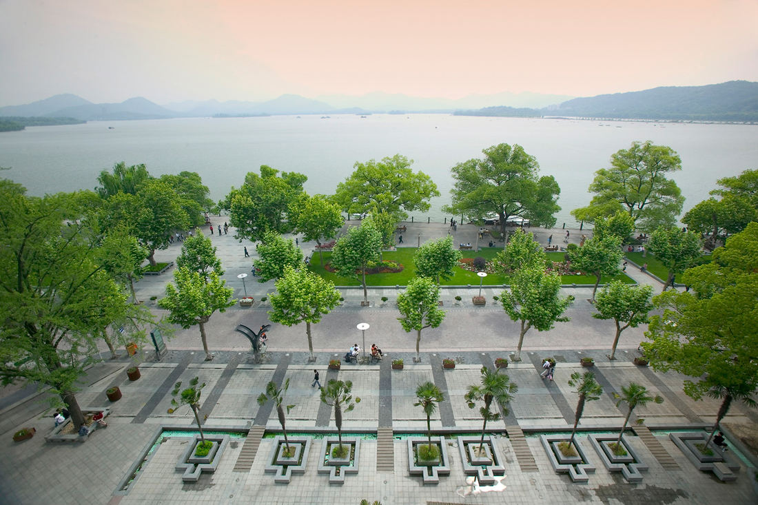
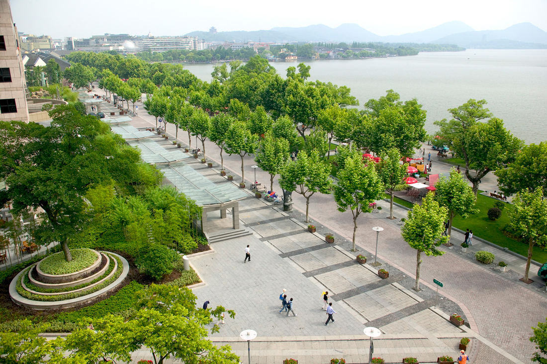
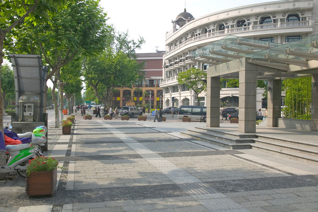
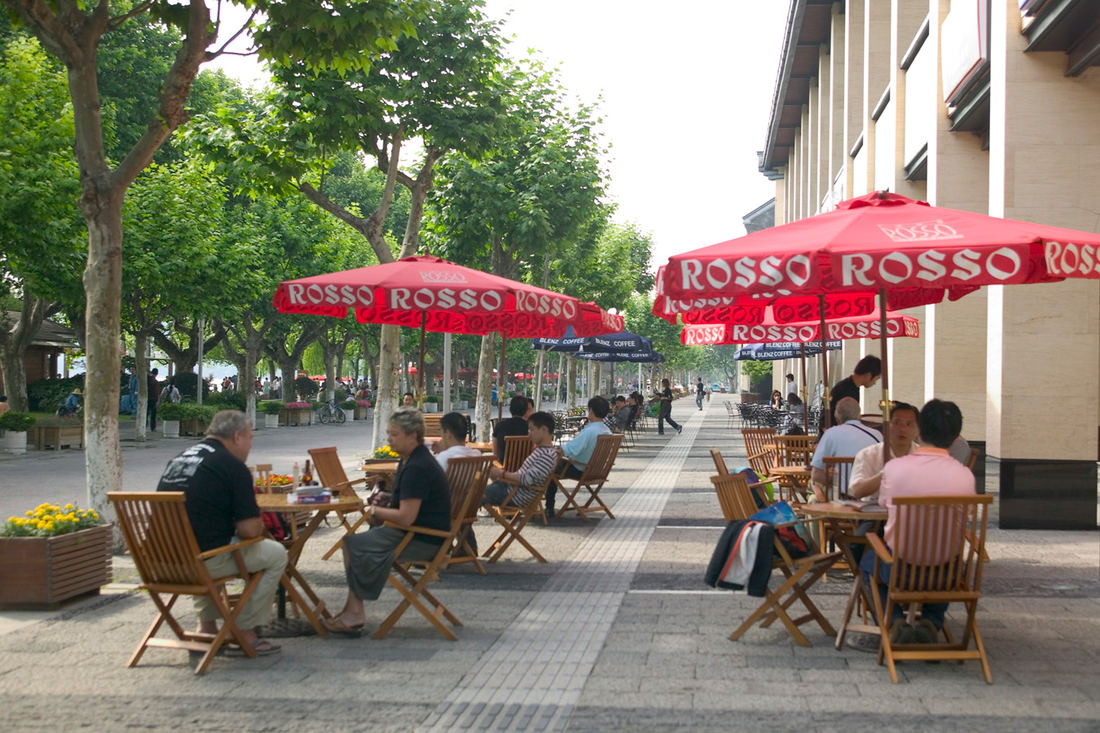
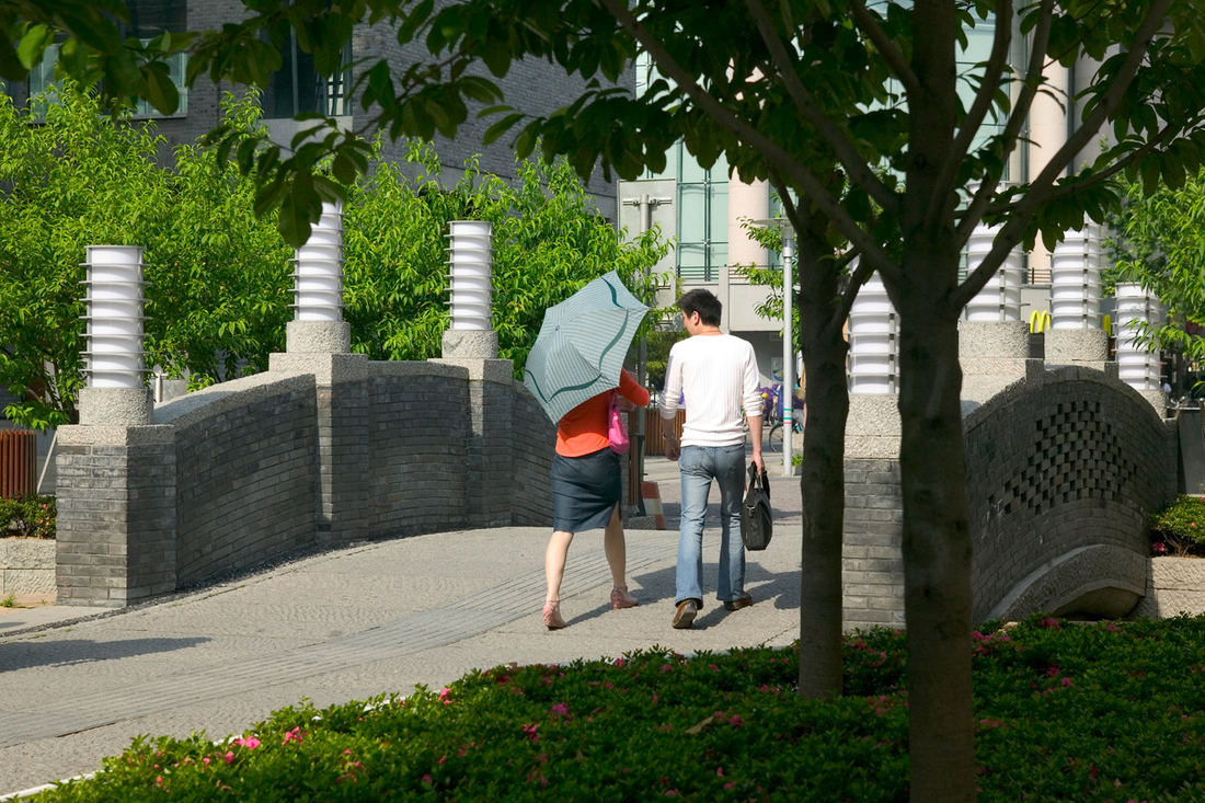
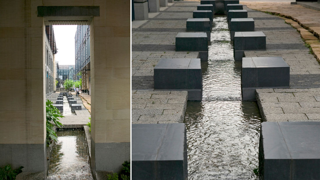
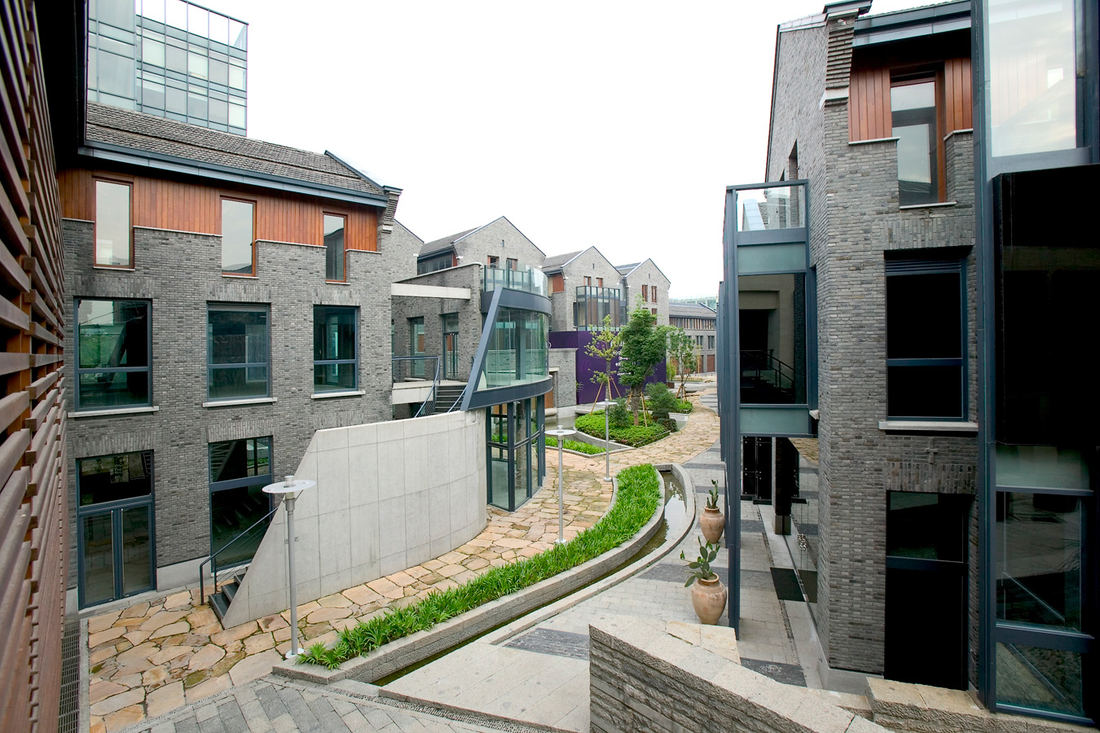
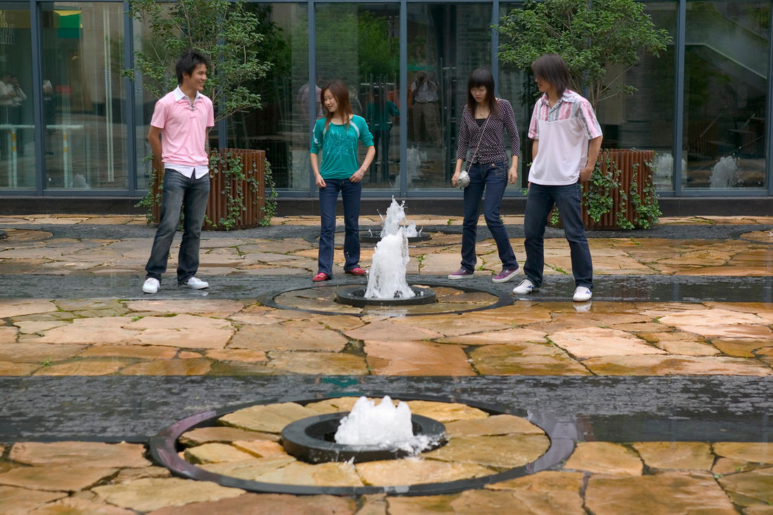
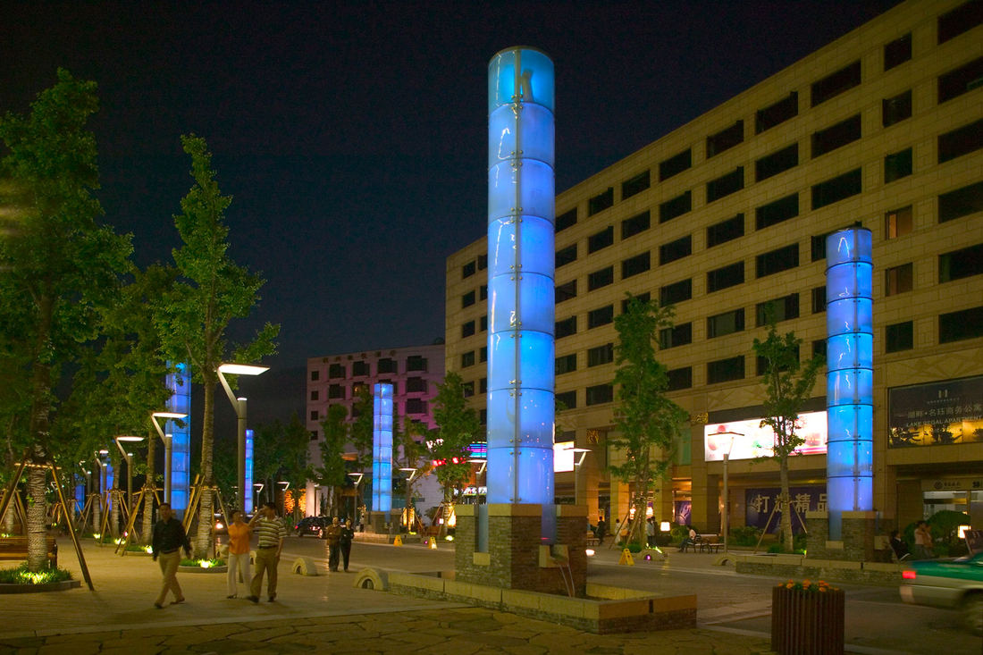
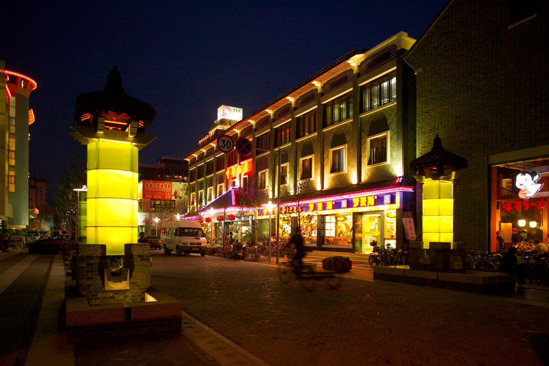
West Lake in Hangzhou, China, one of the world’s most romantic places and as familiar an icon as the Great Wall or the Forbidden City, has been designated by the United Nations as one of the World Cultural Heritage Sites. Seven hundred years later, the city that served ancient emperors as a capitol boasts a population of over three million and is still a cultural center and an important tourist destination in China, with over 30 million visitors a year. As Hangzhou began participating in China’s burgeoning economy, HuBin Road, a multilane highway that borders the scenic lake grew out of scale and became a significant barrier to access to the lakefront. Just a narrow strip of land was available for public use and benefited only the owners of property facing the water. In a concerted effort to ameliorate this obstacle and to revitalize the district, the Hangzhou government formed a public /private partnership: the Hangzhou HuBin Commerce & Tourism Redevelopment Authority. Working with a team of design professionals, including SWA Group of Houston, Zhejiang South Architecture Design Institute and Jerde Partnership International, Inc., the “Urban Design Master Plan for the Hangzhou HuBin Commerce & Tourism District” was developed over a nine-month period. The purpose of the plan was to establish a vision for public and private realms that would unite the history and inherent beauty of West Lake with the east shore District (Hangzhou’s historic city center) to fulfill its destiny as one of the world’s most desired destinations. The master plan encompassed a 1.5 by 1.5 square kilometer area, the first phase of which comprised a third of the area along the West Lake waterfront. In order to recapture the lakefront for urban use, the first impediment to be corrected was HuBin Road. Additionally, planning for development to maximize the lakefront’s potential as a recreational and commercial amenity was crucial. The team developed an innovative plan that redirected through-traffic to a four-lane, 1.5-kilometer-long tunnel under the lakebed, approximately 40 meters from the shoreline. The five-lane road was replaced by a multi-purpose, pedestrian-friendly boulevard with a 650-meter-long by 40-meter-wide tree-lined park, waterfront open space and a pedestrian promenade. Four blocks of retail, office, and entertainment venues were located at the adjacent to the waterfront to ensure the economic success of the project. The new development took the place of a rather bleak commercial frontage that was devoid of greenery or human-scaled amenities. To reconnect the district to the lake, an innovative “City Stream” system was developed. Through the employment of the City Stream, fresh water from West Lake flows once again through remnants of the river and stream segments remaining after urbanization of Hangzhou, thereby improving water quality and restoring the natural hydrology pattern for healthy waterways, as well as forming physical and visual connections to the lake. New courtyards, gardens and plazas are intertwined by flowing streams with pools, fountains and cascades fed by water from the lake. These new open spaces also provide stages for both historic and contemporary buildings. Guided also by the desire to celebrate the history and culture of the HuBin District, historic buildings have been preserved, reconstructed and re-used. In addition to the thousand-year-old temples, pagodas, teahouses and moon bridges that dot the landscape around and within the lake, a number of national museums representative of Chinese culture can be found in Hangzhou. The redevelopment of historic sites as centers for the arts and crafts of the region and for educating the public about Hangzhou’s rich traditions was an important aspect of the project. The Master Plan, which included a Circulation Master Plan, has also transformed the car-dominated environment into a pedestrian-friendly zone by rerouting traffic to roads for commerce and accommodating parking off of “People Streets”–human-scaled multi-purpose streetscapes. True to the crafts and art of the region, the site furnishings and amenities were custom designed to reflect the richness and vibrancy of the city. Historically authentic patterns carved in granite drain inlets and paving and an array of materials-predominately granite, as well as other indigenous stone and fired clay brick–bring a human scale and richness to the pedestrian circulation system. Site furnishings incorporate traditional architectural elements with new materials to enhance the reconnection of the district and waterfront. Rough-hewn stone seats, as well as wood and metal benches, are generously found along promenades amidst the preserved historic Sycamore, Gingko, Camphor, Willow and Peach trees. The District is now replete with exciting streets and gathering spaces that integrate people, bicycles, cars and transit safely. The Master Plan includes an array of public spaces, including Dong Po Plaza, named for the celebrated poet and politician credited with shaping the city of Hangzhou and West Lake. The 10,000 square meter plaza, scaled to accommodate the immense crowds of visitors for various events, is now a major multi-use gathering space which creates a grand forecourt to West Lake. Lighting has been designed to create a vivid and dynamic atmosphere as well as security for the thousands of people who gather nightly in the District. “Water lanterns”, frosted glass cylindrical lanterns resembling pagodas, with color changing lamps, and water fountains, enhance the vibrant promenades and further connect West Lake to the District. “Light Columns” herald the approach to West Lake and landmark Dong Po Plaza. The large plazas are illuminated by more color changing nine-meter-tall glass cylinders. Smaller spaces twinkle with random patterns of changing color lights from beneath the paving and water courses glow in an array of colors. Guided by the precept that the history, people and culture are what define the character and sense of place, the designers have produced an eclectic and poetic mix of old and new which celebrates the qualities of the District. The successful outcome of the Hangzhou waterfront project is an example of a public/private partnership formed to advance a public good and provide opportunities for private real estate development with an aesthetically rewarding design statement. In 2005, the project was one of only three projects world-wide to win the very first Global Award for Excellence from the Urban Land Institute.
Sava Promenada at the Belgrade Waterfront
This one-million-square-meter waterfront development, the single largest regeneration project in Serbia’s history, aims to create a world-class, sustainable destination for civic and cultural attractions, forging human and physical connections to the Sava River where none existed before. Located near the historic town center of Belgrade, the site’s...
Riverside Park South
Located on the West Side of Manhattan on the scenic Hudson River shoreline, Riverside Park South is a massive, multiphase project of sweeping ambition and historic scope. Combining new green space, new infrastructure, and the renovation of landmark industrial buildings, the plan – originally devised by Thomas Balsley Associates in 1991 – is an extension of Fre...
Shekou Promenade
A gateway for China’s open-door policy, Shekou has revitalized its fragmented and hazardous coastline into a dynamic six-kilometer promenade that masterfully captures the area’s cultural and natural essence.
The promenade repurposes the disconnected former industrial waterfront into a celebrated open space system with new recreation programs...
Long Beach Shoreline
SWA prepared a land use and urban design plan for six miles of waterfront adjacent to downtown Long Beach. Through a series of meetings with local community stakeholders, we were able to determine the different needs of each district in the plan: of critical importance was the need to preserve valuable open space inland, and to maintain an ecological corridor ...


