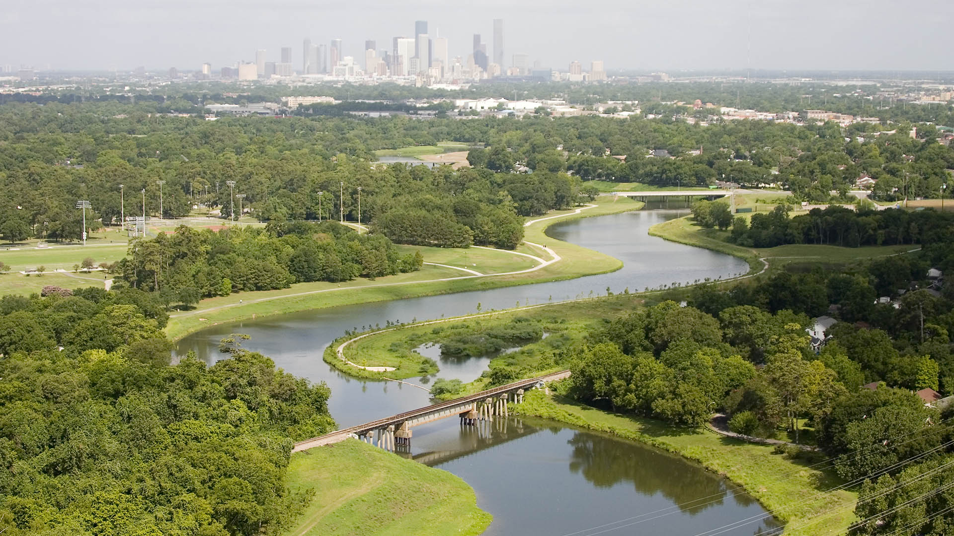
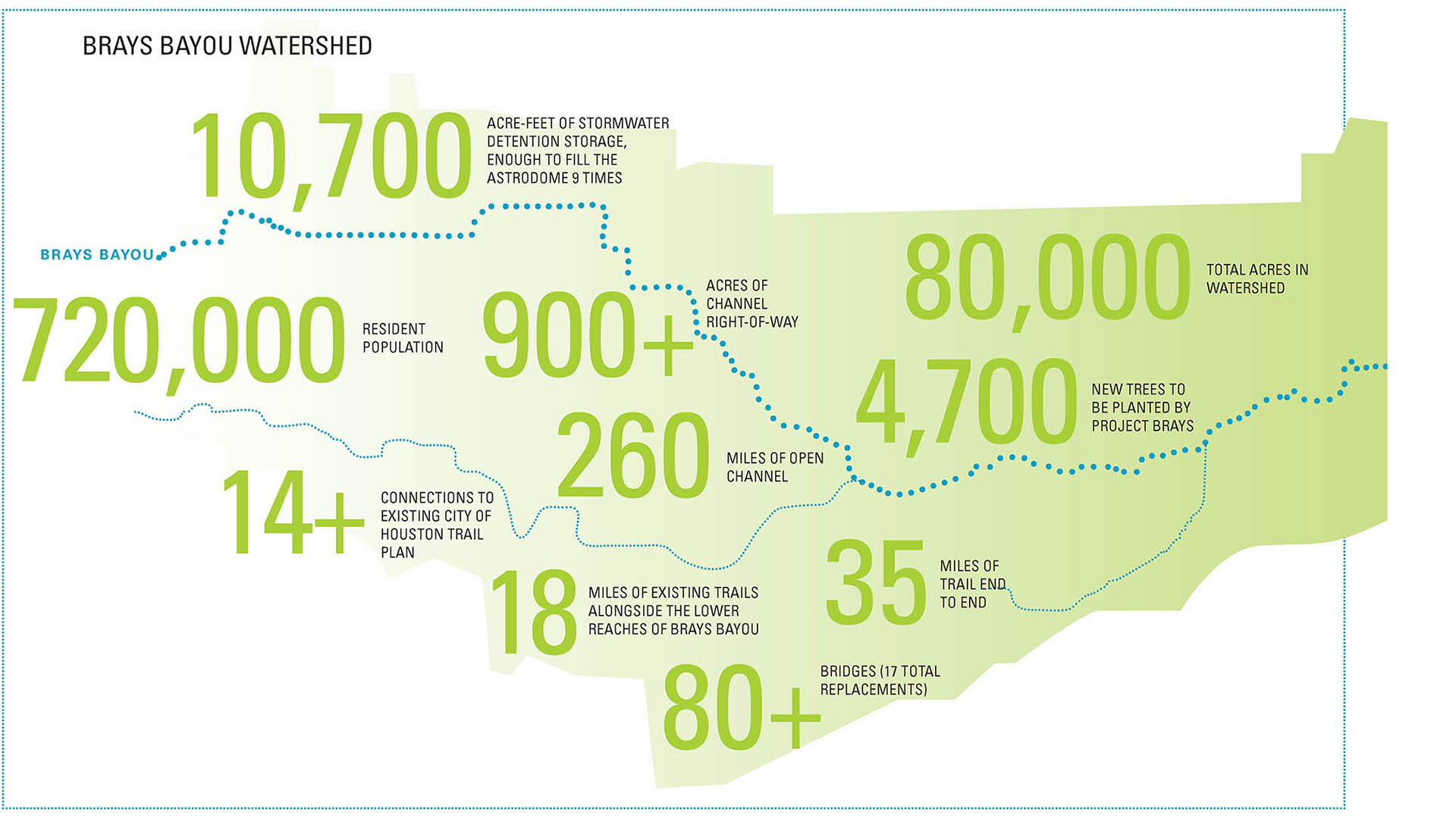
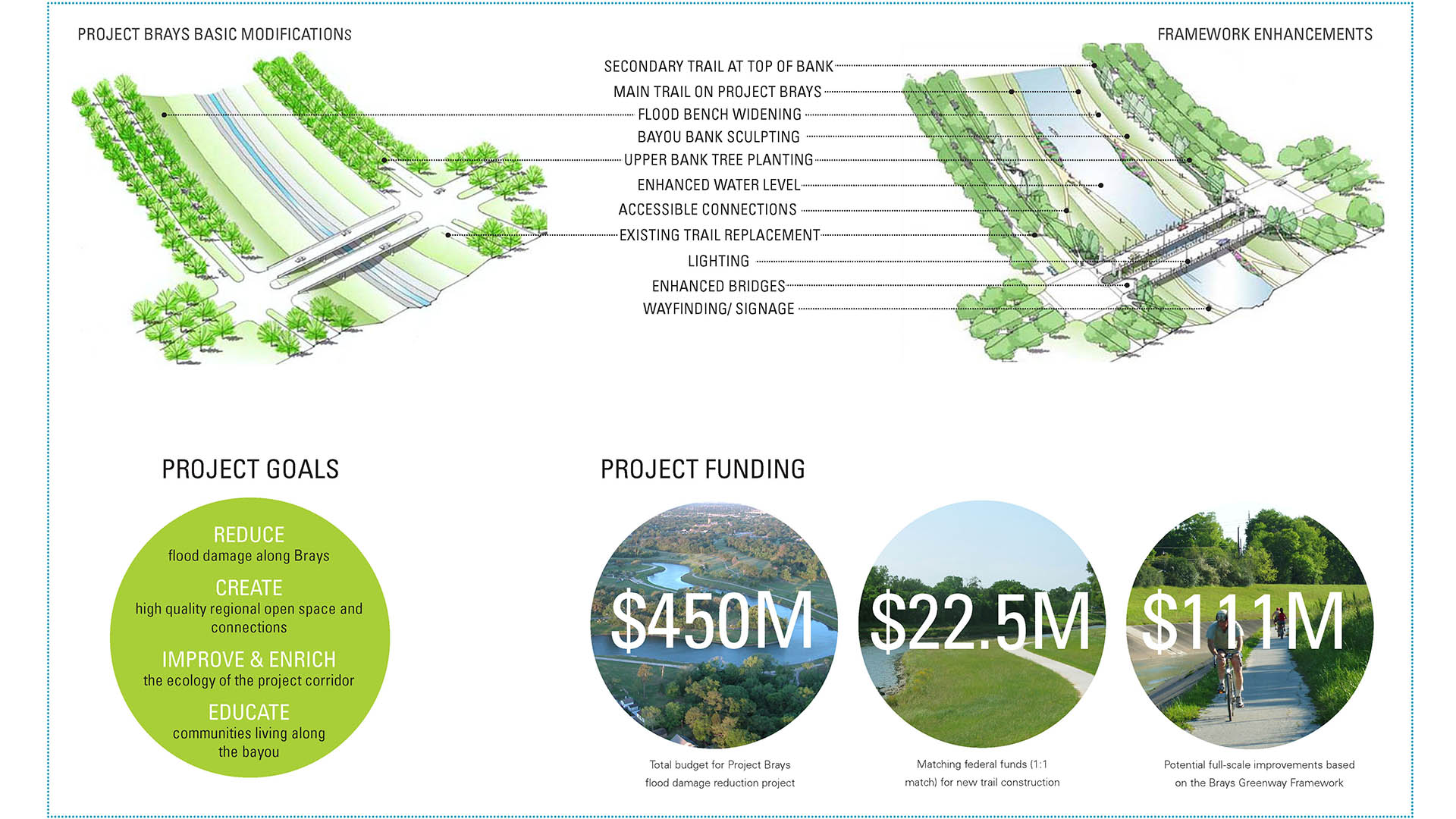
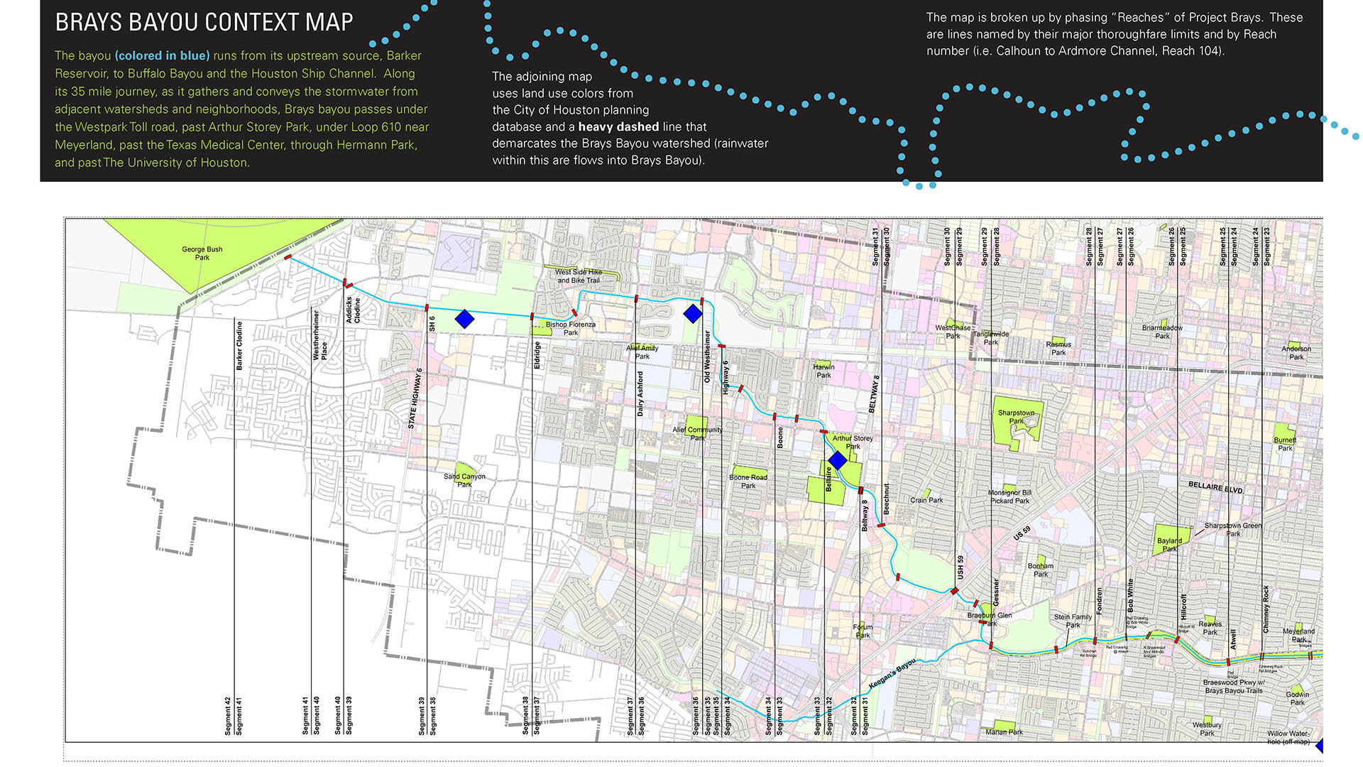
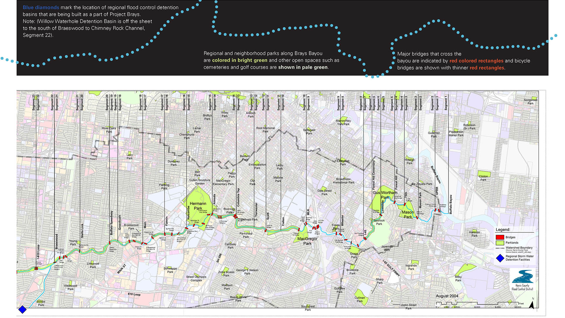
Stretching 35 miles from the mouth of the Houston Ship Channel westward through residential, commercial and institutional developments, Brays Bayou is one of the most important waterways in Harris County, and a critical link in the area’s watershed. The $450-million project was first established in the early 2000s, with the goal of mitigating flood damage. Initially, SWA was charged with increasing the existing channel’s capacity and developing design guidelines for architectural and open space character throughout the corridor.
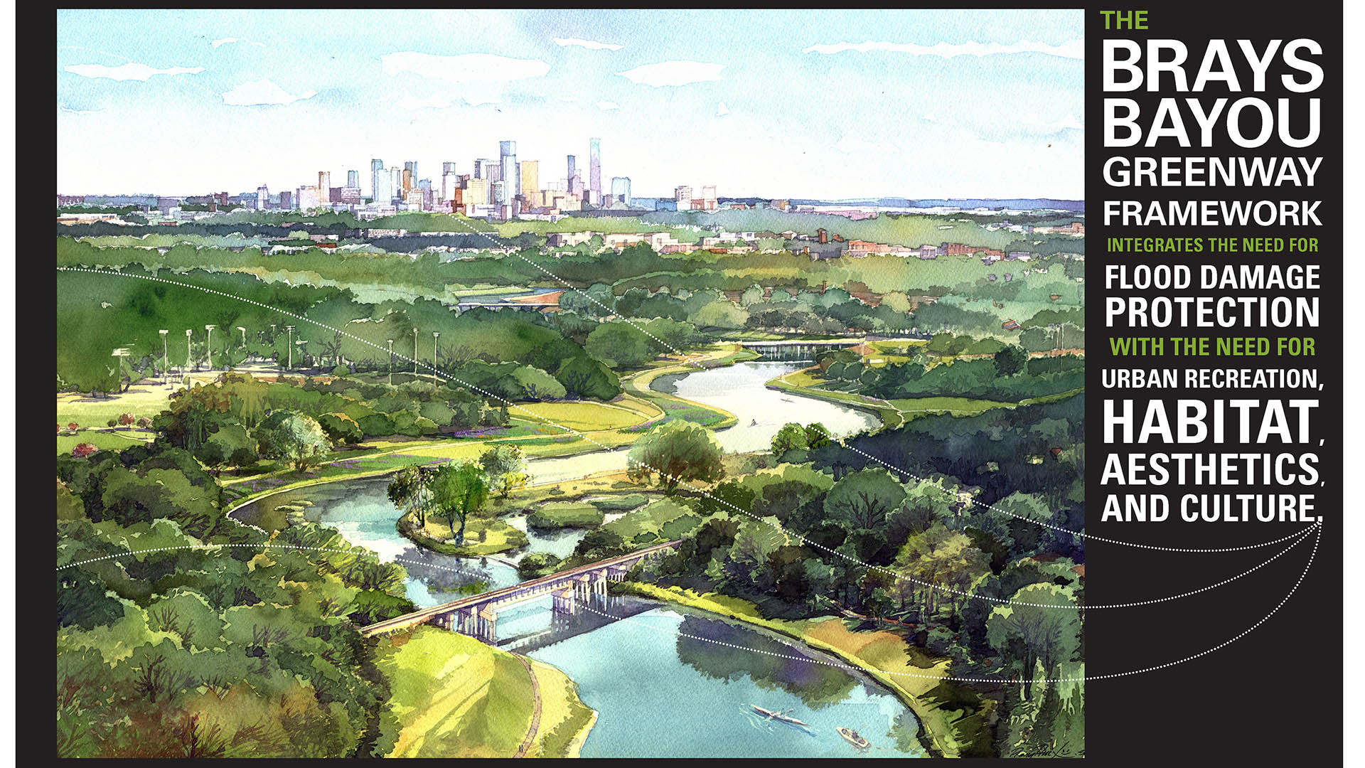
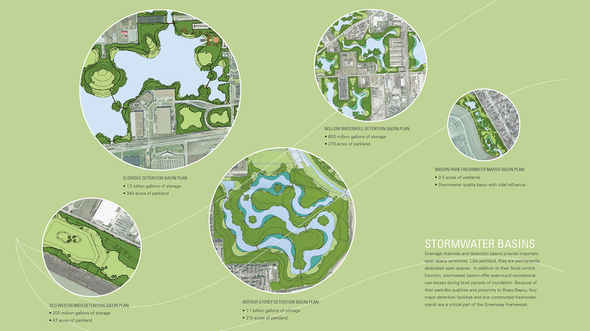
The initial Brays Greenway Framework identified a broad set of recreational and open-space opportunities for target programs from its mouth at Buffalo Bayou (the Ship Channel) to the Barker Reservoir (George Bush Park) in the west. Comprehensive implementation of program elements eventually led to a vision for the greenway that moved beyond its individual components toward the creation of a cherished regional waterway that also acts as a flood-damage-reduction project, protecting homes, businesses, and institutions. Strategies included channel widening and regional detention basins, which laid the groundwork for recreation improvements within the channel’s right-of-way. SWA’s recommendations encompassed land acquisition strategies, bridge constructions/enhancements, trail construction, landscaping, and other amenities.
SWA worked with a large team of specialists researching funding mechanisms, organizational structures, community coalitions, design concepts, property acquisition, and surplus property, among other strategies. Partners included universities, parks departments, green space advocacy groups, and private companies, with whom SWA worked in concert toward providing access, recreation, and connection for the entire length of the Bayou.
Hunter's Point South Waterfront Park
Hunter’s Point South Waterfront Park was envisioned as an international model of urban ecology and a world laboratory for innovative sustainable thinking. The project is a collaboration between Thomas Balsley Associates and WEISS/MANFREDI for the open space and park design with ARUP as the prime consultant and infrastructure designer.
What was once a ba...
Sands Bethworks
One of the most prominent examples of redirecting the environmental legacy of a post-industrial landscape can be traced to the south banks of the Lehigh Canal, in the city of Bethlehem, Pennsylvania. Comprising 1,800 acres (20 of which belong to this project) and 20 percent of Bethlehem’s total land mass is the former headquarters of Bethlehem Steel Corporatio...
Mason Park Bridge
Mason Park, located at the confluence of two bayous, has served as an urban oasis since 1928. Despite a century of improvements to amenities, user access was significantly compromised by the wide expanse of Brays Bayou, which bisected the 104-acre green space into distinct northern and southern sections. Adjacent road and rail infrastructure further exacerbate...
Shunde New City
The Pearl River Delta is the second largest bird migration delta and estuary in Southeast Asia. Preserving and restoring bird and wildlife corridors while also providing regional connectivity, transportation, and development options is at the pinnacle of today’s development challenges. In the Shunde New City Plan, urban development and nature are integra...


