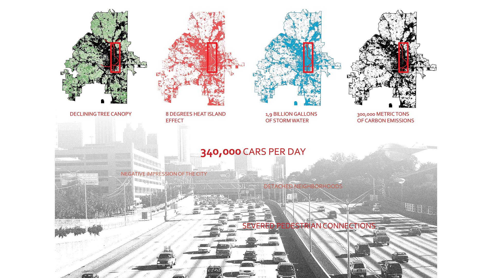
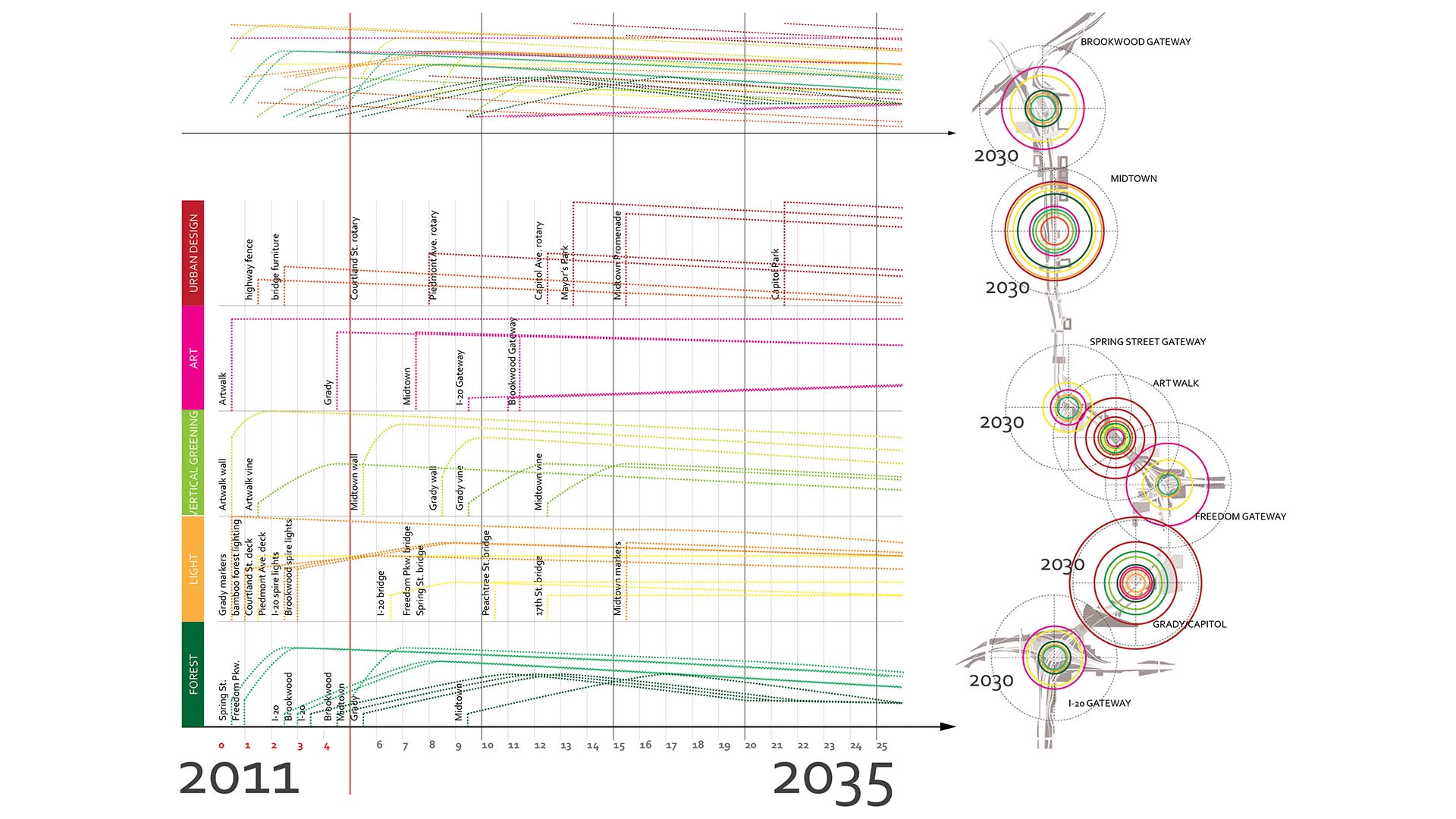
The freeway is an integral part of the open space of the American City, a series of infrastructural systems that affect the spatial characteristics of our natural and cultural landscapes. The Atlanta Connector Transformation Project is a collaborative effort between the City of Atlanta, Georgia Department of Transportation, Downtown and Midtown to improve the experience of the more than 300,000 people who travel along the I-75/85 Connector daily.
By re-inventing how we see and care for our infrastructure, the transformation of the Connector serves as a catalyst that can change the perceptions of our freeways. Embedded in our landscapes and urban environments, the quality of our connectors also influences the urban character of adjacent properties, neighborhoods, and the City as a whole.
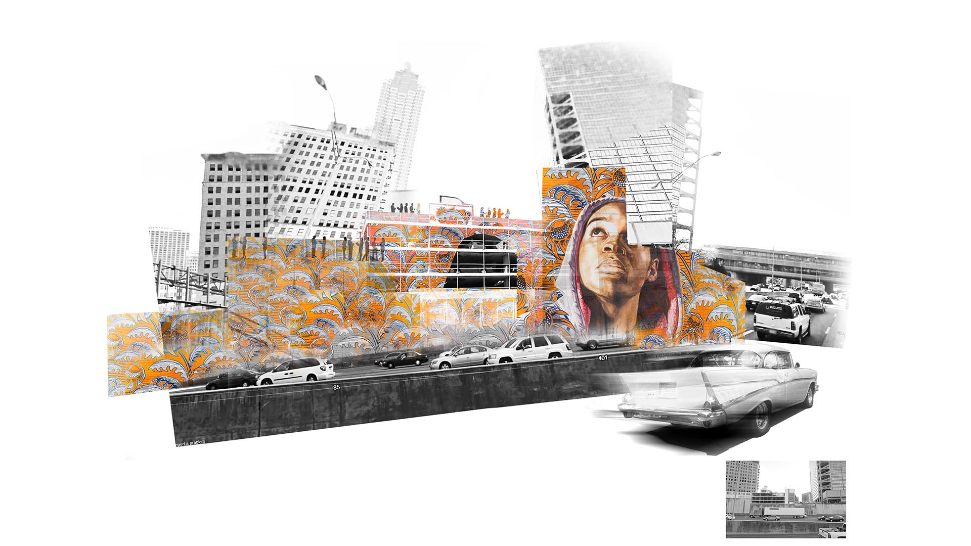
In its current state, the Connector creates a decidedly negative environment for the City of Atlanta, damaging both the visitor’s opinion of the City and its urban fabric. This in turn affects connectivity, transit ridership, tourism, and ultimately tax revenues and jobs in the urban core. The main strategy employed in the transformation of the Atlanta Connector is re-envisioning the freeway as a bold stroke of landscape infrastructure which creates a simple framework derived from movement, views, and connectivity with the urban community adjacent to, and beyond the Connector.
Over the last decade and a half Downtown and Midtown Atlanta have become models for urban redevelopment. Thousands of new housing units; millions of square feet in new office space; expansion of educational and cultural facilities; and over $50 million in transportation improvements, public safety initiatives, and environmental enhancements have reshaped Atlanta’s urban core into a vibrant, walkable, cosmopolitan center. Despite the recent recession, Midtown and Downtown continue to gain acclaim for their progress and livability. While we take great pride in those achievements, our success has not translated to our City’s most heavily traveled roadway.
The condition of the Connector stands in stark contrast to our improved urban centers. The 5-mile stretch of highway is marked by aging infrastructure, concrete retaining walls, and limited landscaping and maintenance. Despite significant redevelopment that has taken place within the urban districts, a number of large parcels adjacent to the Connector are vacant and unattractive.
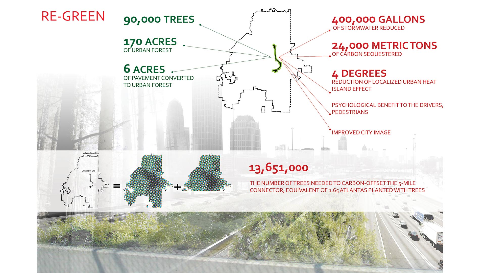
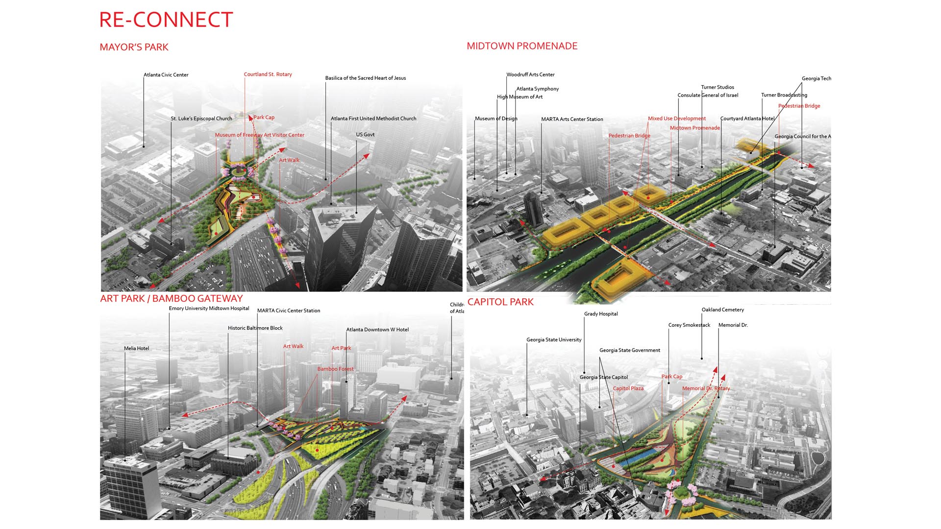
The goal of the Atlanta Connector Transformation Project is to generate beautification and urban design strategies that will create a new front door for the City of Atlanta and energize the margins of this neglected corridor. By looking at the Atlanta Connector as a public open space threading through the heart of the City, the transformation of the freeway can become the catalyst for a new public open space that is green and cooling, solves environmental issues, incorporates art, and changes an eyesore into an amenity for Atlanta.
John Wayne Airport
SWA served as landscape architects at the new airport terminal located in urban Orange County. Landscape improvements, totaling 20 acres, consisted of a large open area adjacent to the terminal, and narrow planting areas framing the site. The particular challenge was to create an appropriate image and scale for a civic project of enormous scale, including park...
ARTIC – Anaheim Regional Transportation Intermodal Center
ARTIC, the new 16-acre Anaheim Regional Transportation Intermodal Center in Southern California, forms a seamless gateway from Anaheim to all of Orange County, spurring economic growth and community redevelopment throughout the region. The landscape design establishes a unique and identifiable image for the ARTIC Mixed-Use District by complementing the site’s ...
Buji River Urban Redevelopment Plan
The Buji River urban review master plan integrates strategies of recreation, reconnection, culture, and ecology to bring the river back to the people of Shenzhen. Based on a restored Buji River ecosystem, the urban review master plan for this flourishing environment aims to reconnect the river with the city.
The program is to be implemented at three sca...
Diridon Station Area Plan
In the area around Diridon Station, the City of San José and the greater Bay Area region have the unique opportunity to build an internationally prominent transportation hub and to develop a world-class destination. This plan weaves new ideas and new development possibilities into the city’s distinctive neighborhoods and existing urban fabric. Large proposals,...


