
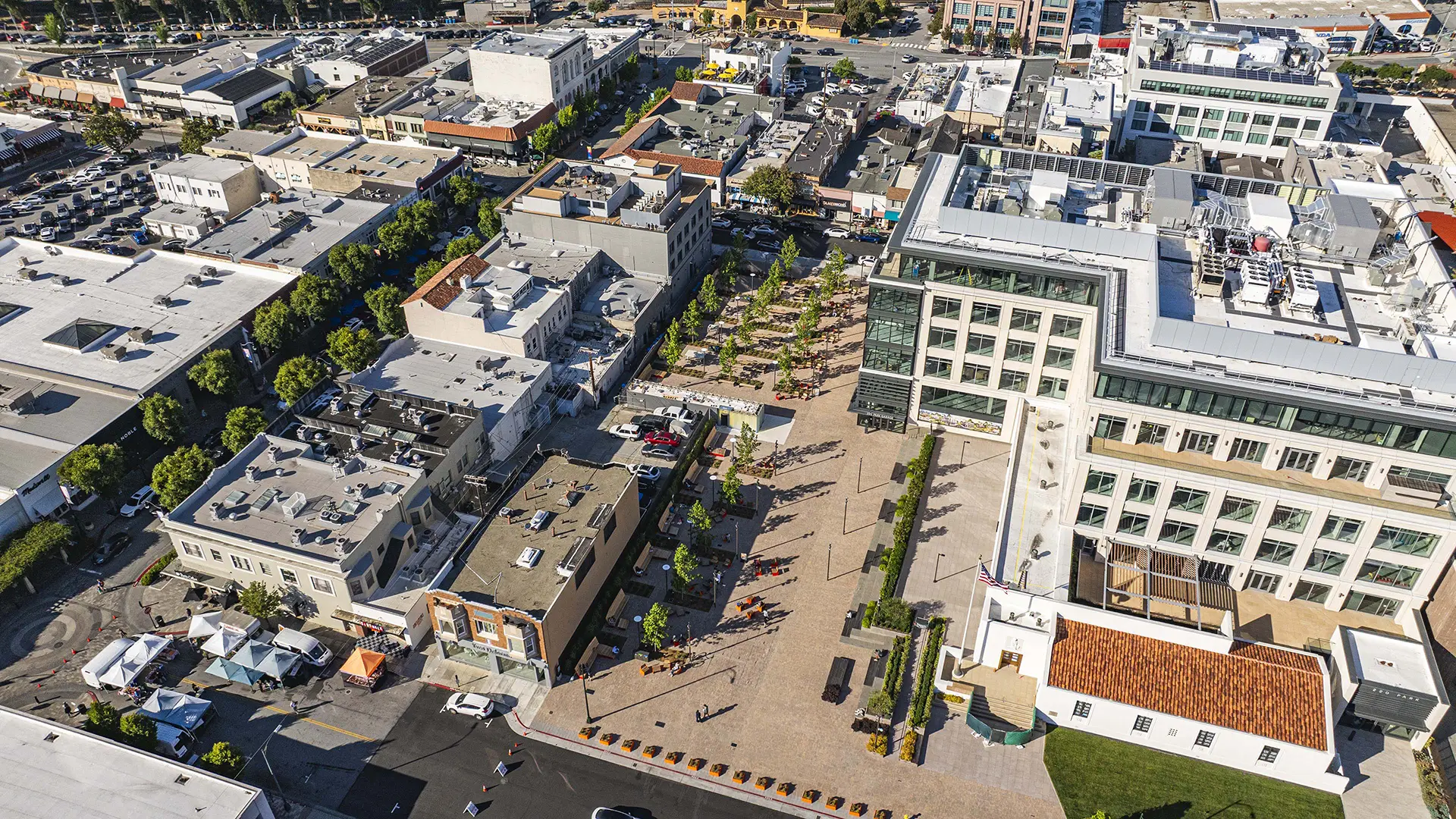


Since its founding in the early 1900s, Burlingame lacked a signature downtown open space. In 2009, the mayor and council kicked off an initiative to make downtown more pedestrian-friendly, including enhancing the Burlingame Avenue retail main street. The capstone of that initiative is the transformation of a one-acre parking lot between Park Road and Lorton Avenue into an outdoor living room—opening in 2026 as Burlingame Town Square.
Organized into two distinct zones, the Town Square is overlaid with a grid of deciduous trees, seating clusters, and large custom wood slat benches along the sunny northwest edge. The Park Road half of the Square includes flexible space and a small performance area to host markets and festivals, while the Lorton Avenue half features communal tables and outdoor games. Flanking curbs are designated for drop-off, supporting the Square as a natural meeting and socializing spot downtown.
Midway through the Square, a water feature clad with angled panels of cast dichroic glass shifts from icy white to aqua, gold, and royal blue depending on sun angle and viewing position, screening a public restroom. Throughout, the design features a warm modern design vocabulary with a palette of oranges, reds, and rusts recalling the brick façades and outdoor dining along Burlingame Avenue. After dark, theater-grade projectors wash the Square’s main walk with a shimmering light artwork evoking Burlingame Creek, now culverted below ground.
Through a partnership between the City and developer of 220 Park, an adjacent six-story office building with ground-level retail and an adaptive reuse of a 1941 Art Deco post office, the Square extends beyond the City’s parcel into this development with additional paving, seating terraces, and an elevated dining area and restaurant. Over time, other surrounding buildings are anticipated to open up to the Square, completing its function as a defining civic gathering space for Burlingame.
Cool & Connected Corridors
Houston is one of the hottest cities in the U.S.—especially downtown, with limited tree canopy and long stretches of exposed pavement. Opening ahead of the 2026 FIFA World Cup, Cool and Connected Corridors is a phased effort to make Downtown Houston more walkable, comfortable, and legible in a hotter climate. The first phase focuses on Texas Avenue, a key east...
Lynwood Mega-Playground
Inspired by the city’s rich history of aerospace research and manufacturing, Lynwood Mega-Playground brings a dynamic space exploration-themed playground to the heart of the Central Los Angeles city.
Completed in Fall 2024, the playground transforms the Northwest corner of Lynwood Park into a colorful spectacle with super-sized play features including a...
Gantry Plaza State Park
Once a working waterfront teeming with barges, tugboats, and rail cars, the Hunter’s Point shoreline slowly succumbed to the realities of the Post-Industrial Age and this spectacular site was left to deteriorate. Thomas Balsley Associates, together with Weintraub di Domenico, envisioned Gantry Plaza State Park as a place that celebrates its past, future, skyli...
Culver Steps and Main Plaza
As cities consider the future of their streets in light of pandemic-inspired innovations and federal infrastructure investment, placemaking solutions can help communities achieve more value from public rights-of-way.
In Culver City, California, landscape design born of collaboration from the public and private sectors has resulted in a lively and access...