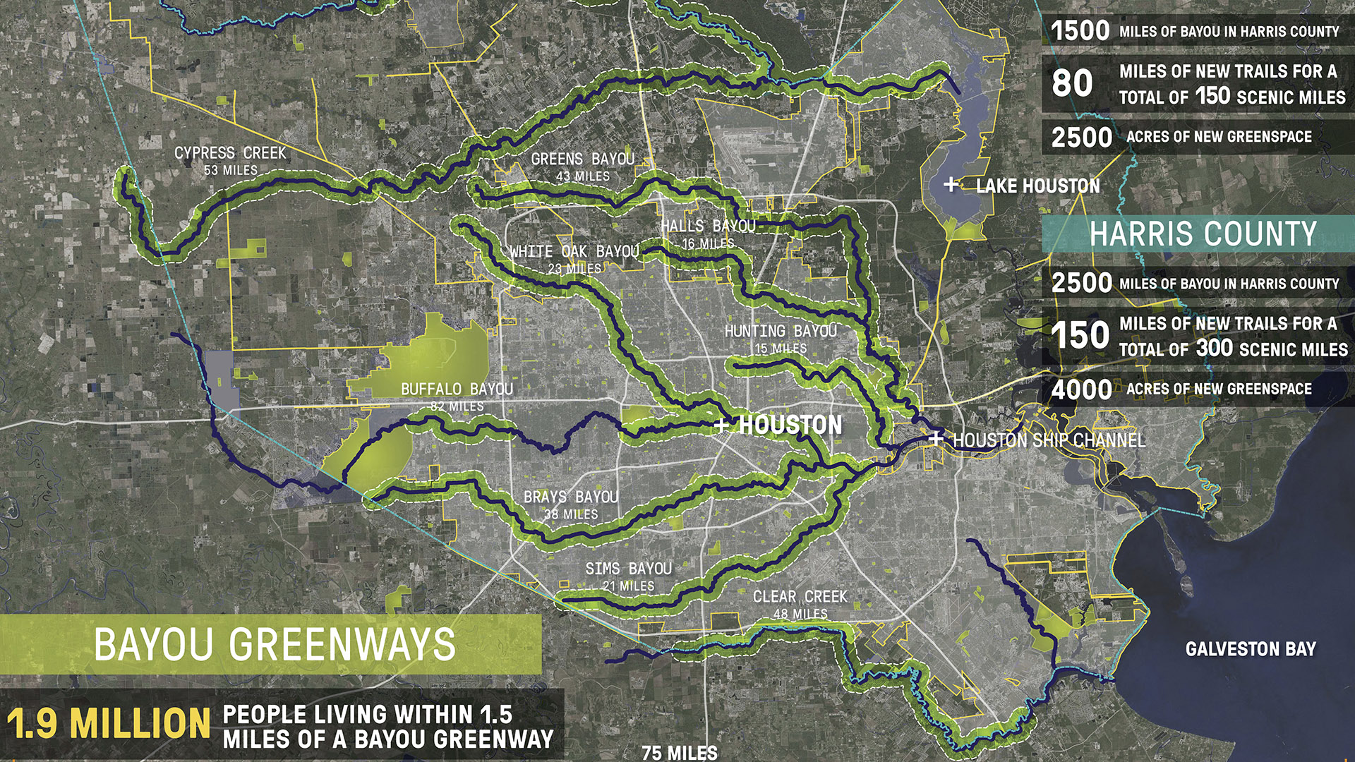
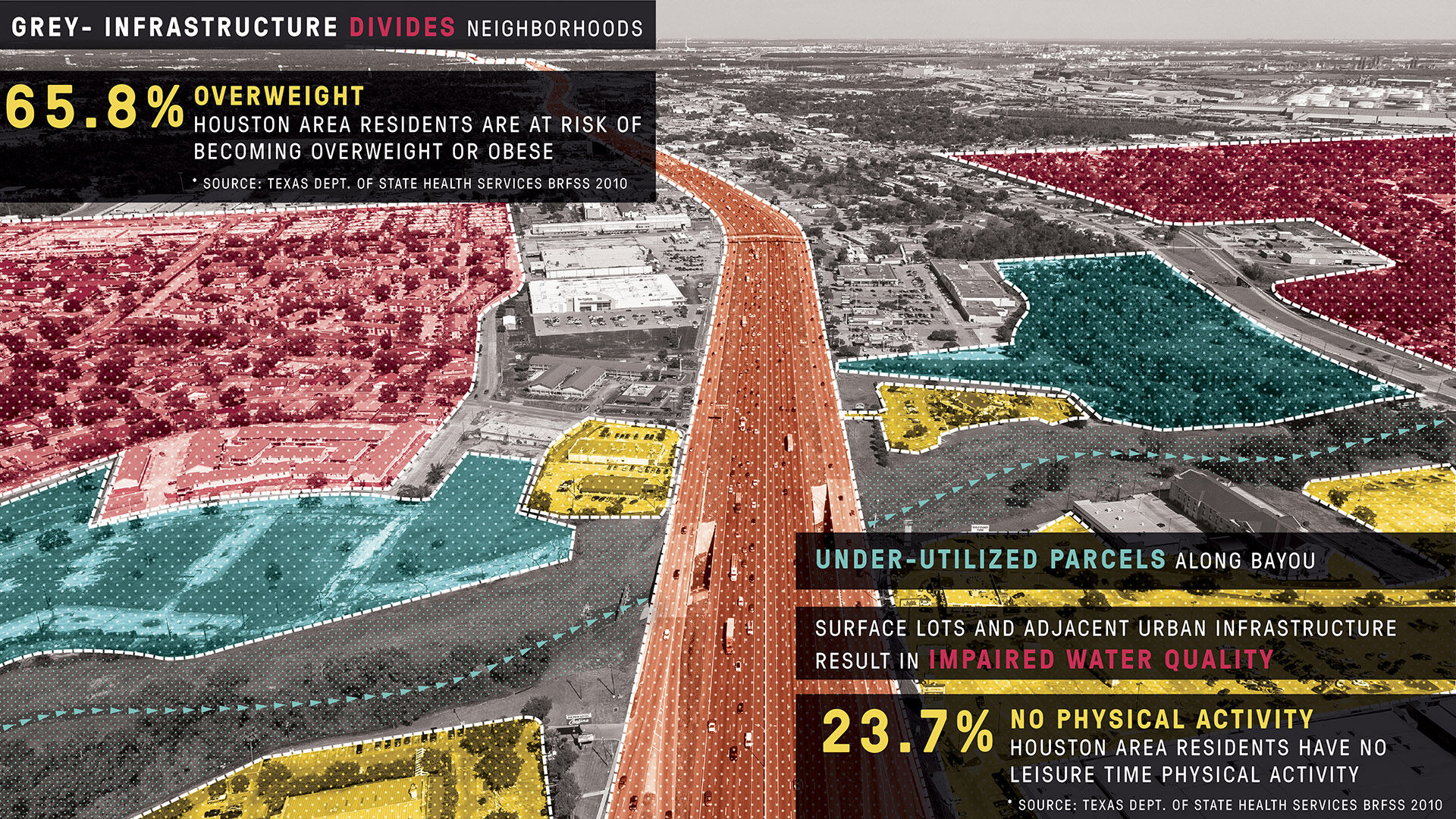
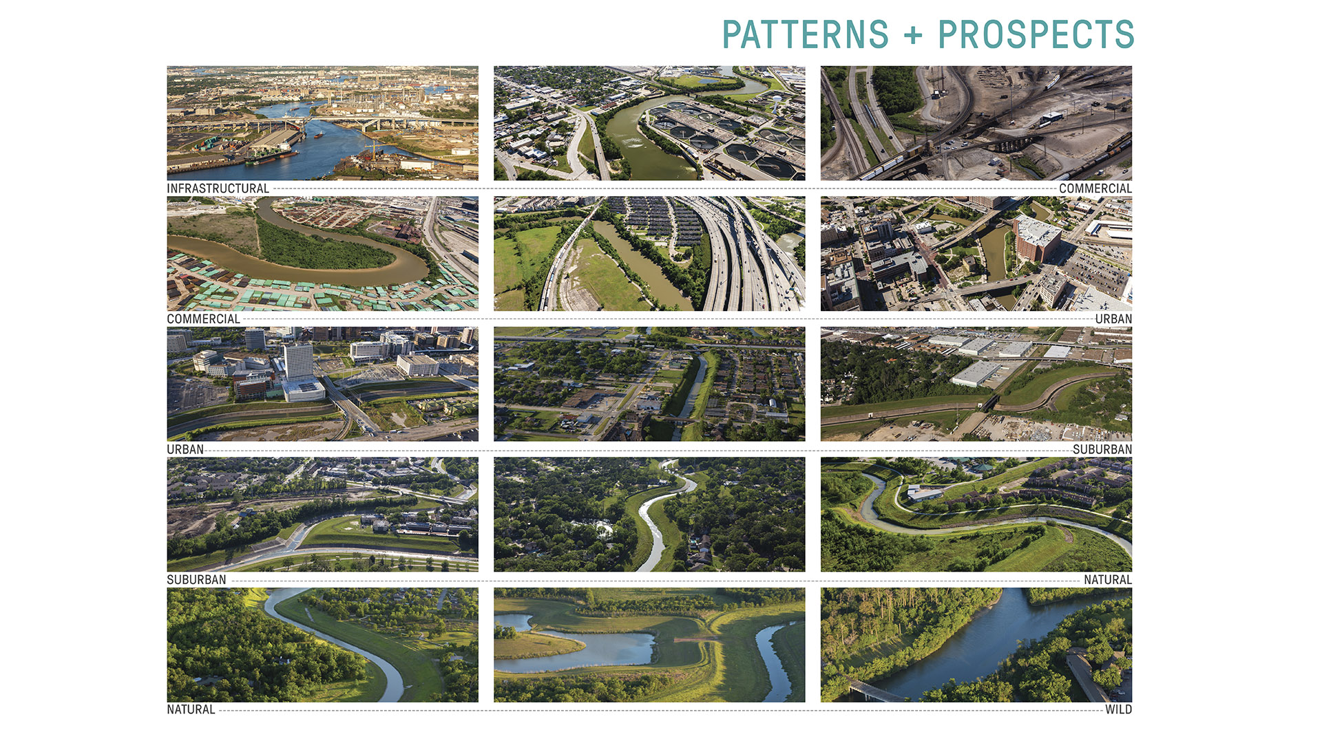
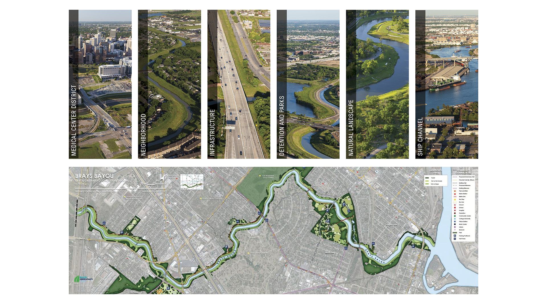
As one of the largest U.S. cities, Houston’s sprawling, car-centric infrastructure is underpinned by a vast arterial system of over 2,500 miles of bayous—an untapped ecological feature that could redefine urban life.
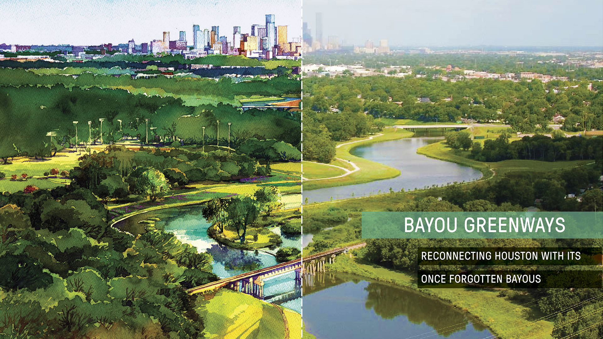
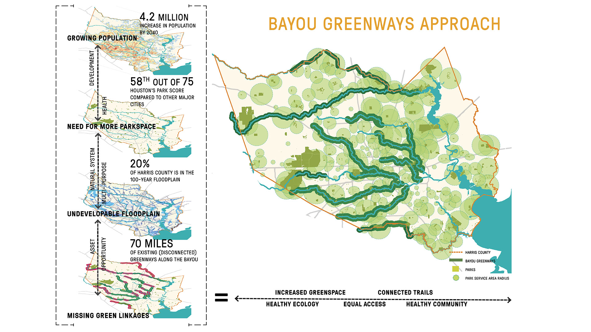
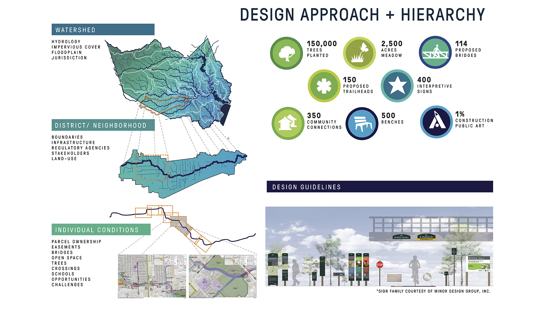
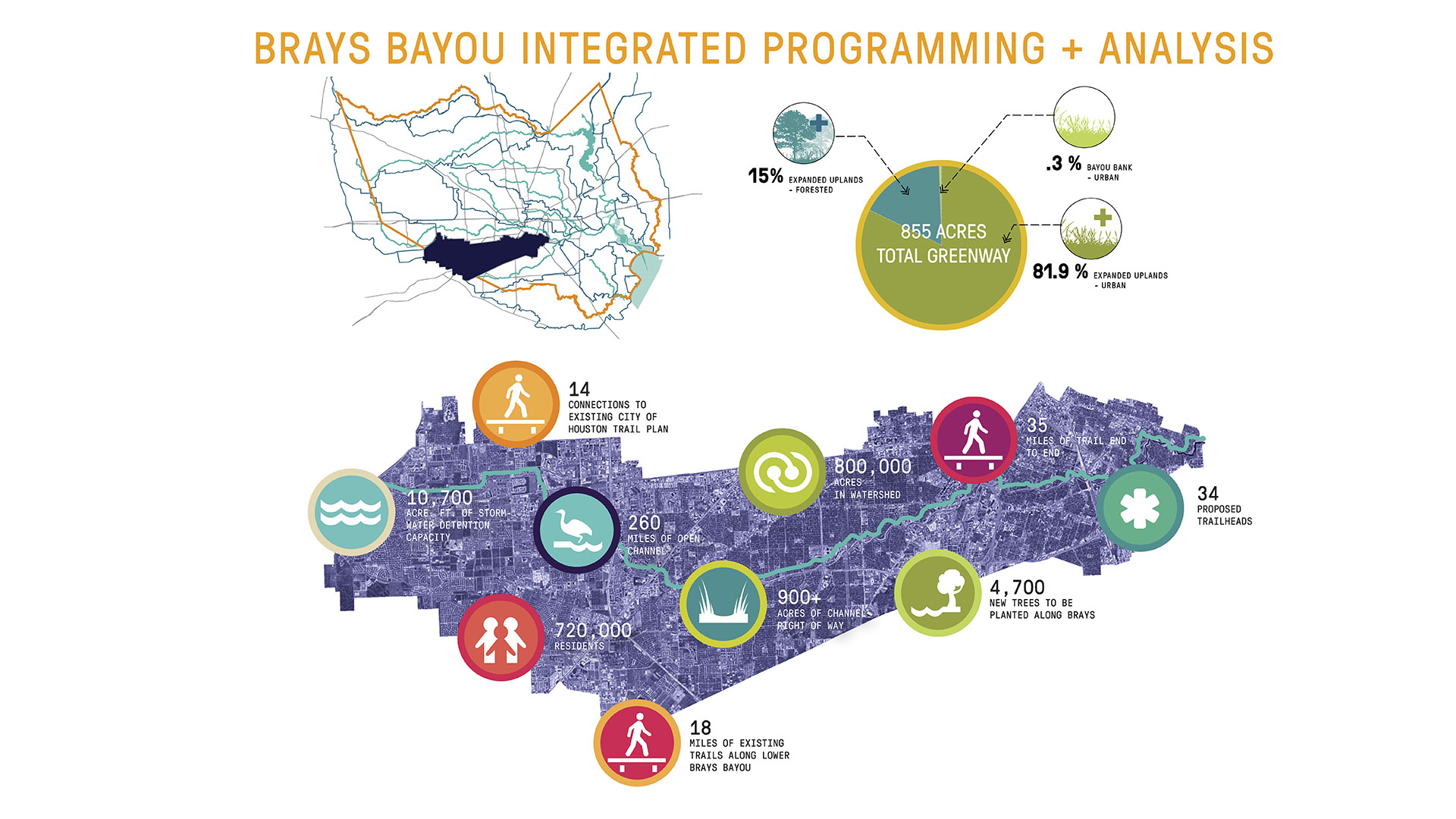
Recognizing this potential, the Houston Parks Board worked alongside SWA to develop a visionary plan for nine central bayous as an interconnected park system, bringing 60% of Houstonians within 1.5 miles of green space.
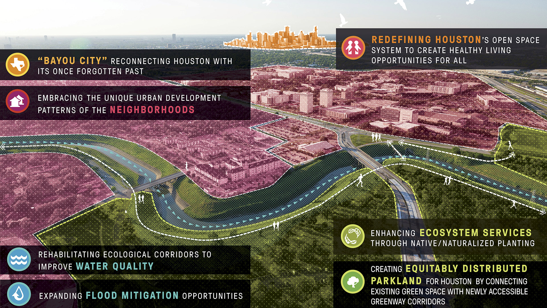
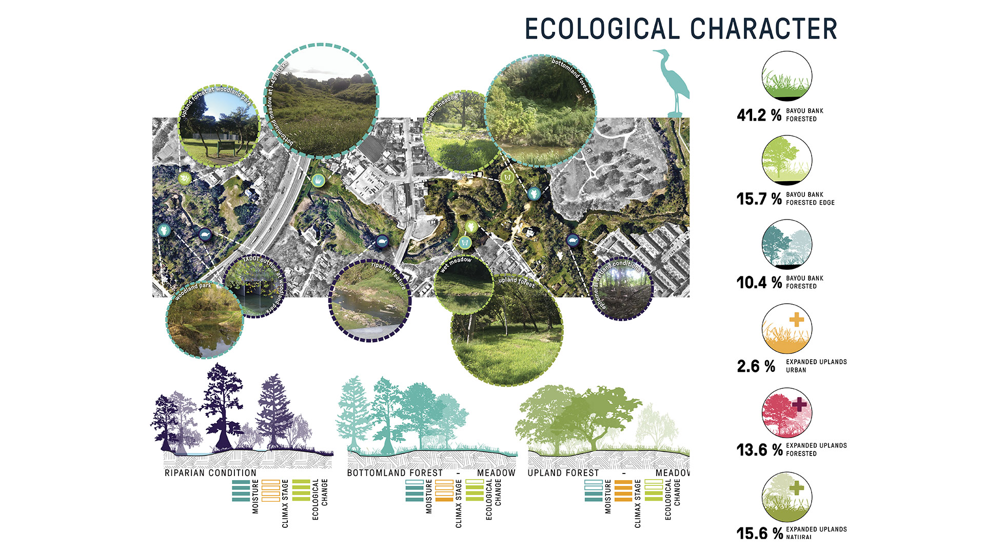
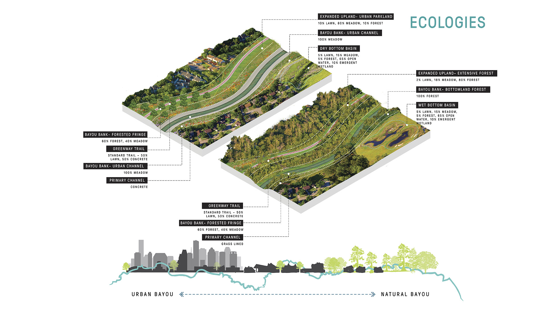
The network was reimagined as a 3,000-acre greenway and blueway system linking neighborhoods with multimodal trails and restored habitat. Named Bayou Greenways, the master plan represented a shift in Houston’s approach to designing with water—framing it as a civic asset rather than a source of risk. The framework identifies opportunities to enhance ecosystem performance while reducing flood impacts on adjacent neighborhoods, carving out space for direct water access and alternate modes of transit.
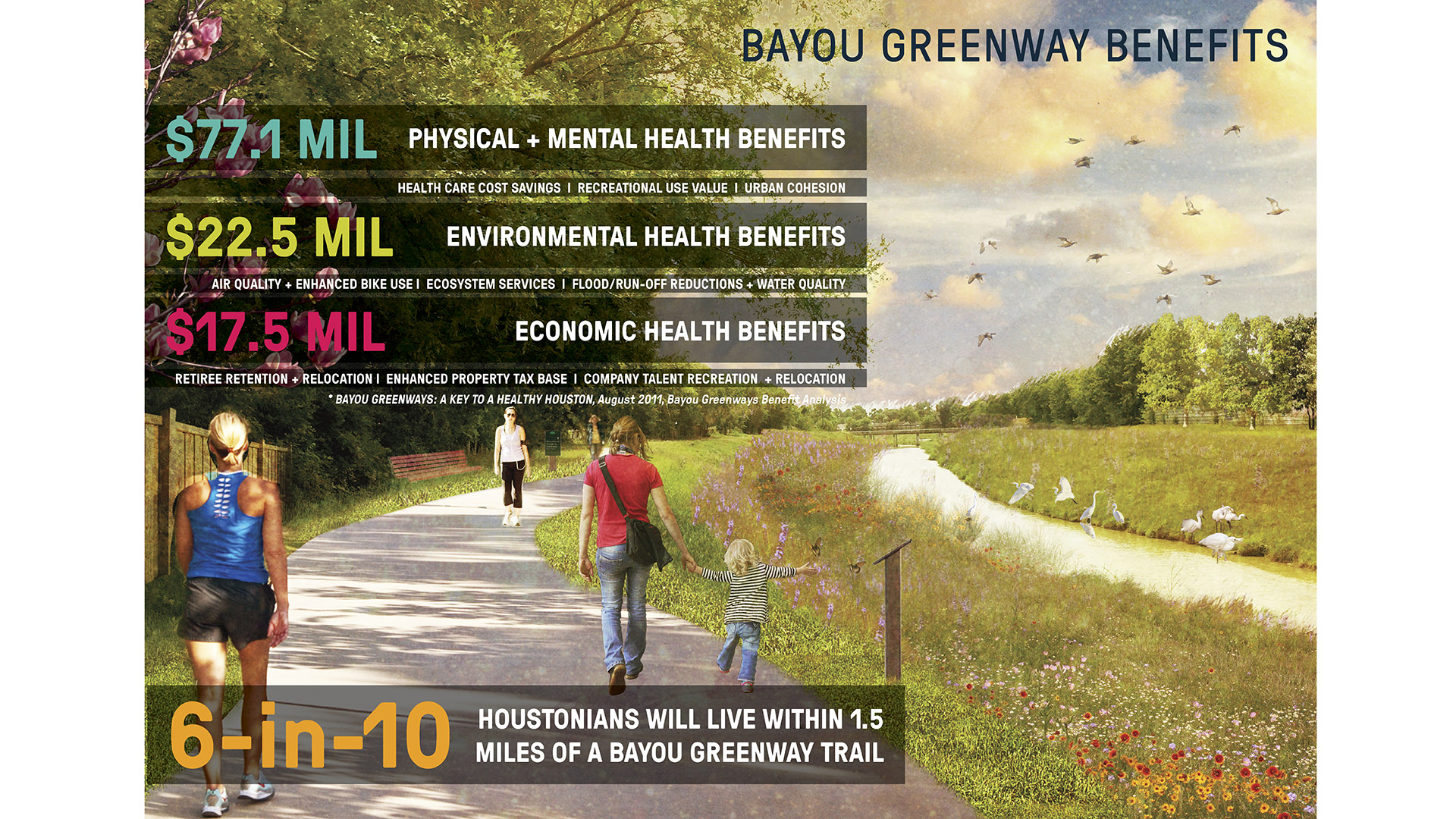
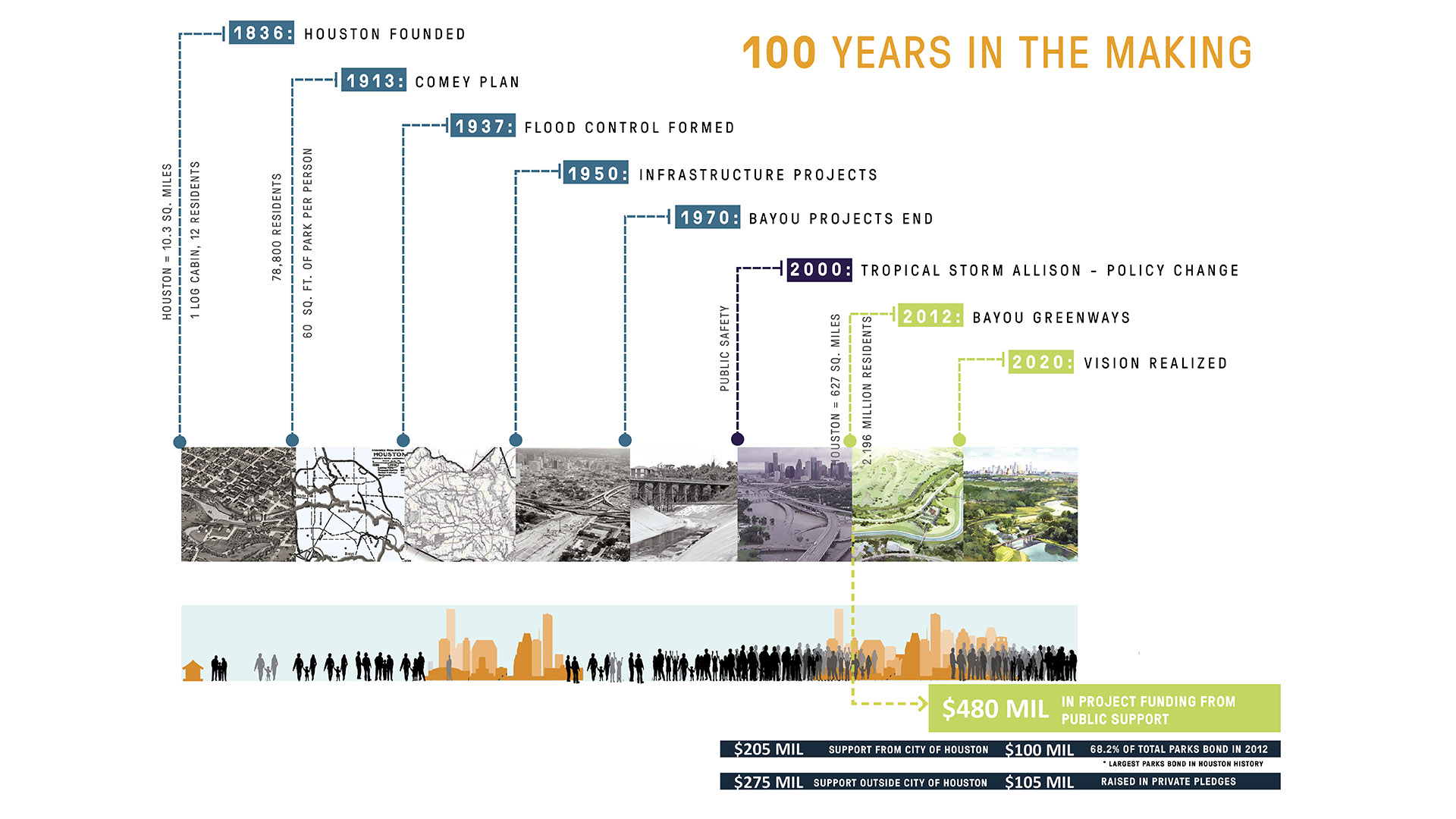
The monumental task required a decade-long collaboration between the Houston Parks Board, City of Houston, Harris County Flood Control District, and numerous stakeholders. Beyond recreation, the Bayou Greenways initiative embodies a broader vision for living in Houston—prioritizing health, resilience, equitable access to open space, and authentic connectivity to the city’s natural heritage.
Bend of the River Botanic Garden
The Bend of the River Botanic Garden Master Plan reimagines an 88-acre site in Temple, Texas, into a regional attraction. Situated at the intersection of I-35 and the Leon River, the site comprises two donated parcels, consolidated to serve Temple’s growing population of over 96,000.
SWA led a comprehensive public engagement process, facilitating conver...
Milton Street Park
Milton Street Park is a 1.2-acre linear urban park alongside the Ballona Creek Bike Trail in Los Angeles, California. The plan incorporates numerous green-design elements, including the use of recycled materials, native planting, flow-through planters and treatment alongside the 1,000-foot-long, 45-foot-wide stretch of land. A variety of special elements such...
Larchmont Yacht Club
Larchmont Yacht Club is the second-oldest yacht club in the United States. Conceived in 1880 on the cleft rocks of Larchmont Manor, the club has grown to a membership in excess of 600, with a continued mission to instill and enhance an interest in yachting and the spirit of sportsmanship in members and their families. Set within a mature forest of deciduous tr...
Naftzger Park
Naftzger Park offers a contemporary and communal gathering space in downtown Wichita with enough variety to appeal to everyone. Designed to activate an area of town between Old Town and a burgeoning new entertainment district, the park is at once an urban foyer and outdoor recreation room. A contemporary pavilion can accommodate picnic tables by day and perf...


